Welcome!
Thank you for visiting the Maine Coastal Public Access Guide, a compendium of publicly accessible beaches, boat launches, parks, and trails in Maine’s 144 coastal municipalities and townships. The sites include federal, state, municipal, and publicly accessible private lands, including land trust properties.
Maine Coastal Public Access Guide (Southern Maine)
Maine Coastal Public Access Guide PDF
- South Berwick, Eliot, Kittery, York (PDF file, 50MB)
- Ogunquit, Wells (PDF file, 24MB)
- Kennebunk, Kennebunkport (PDF file, 31MB)
- Biddeford, Sace, Old Orchard Beach (PDF file, 29MB)
- Scarborough, Cape Elizabeth, South Portland (PDF file, 25MB)
- Portland (PDF file, 43MB)
- Portland Islands (Peaks Island, Little Diamond Island, Great Diamond Island, Cliff Island), Long Island (PDF file, 24MB)
- Chebeague Island, Falmouth, Cumberland (PDF file, 19MB)
- Yarmouth, Freeport (PDF file, 7MB)
These printable PDFs contain information about the amenities and uses of each public access site in the listed municipalities.
Maine Coastal Public Access Guide Webmap
Link to the Maine Coastal Public Access Guide
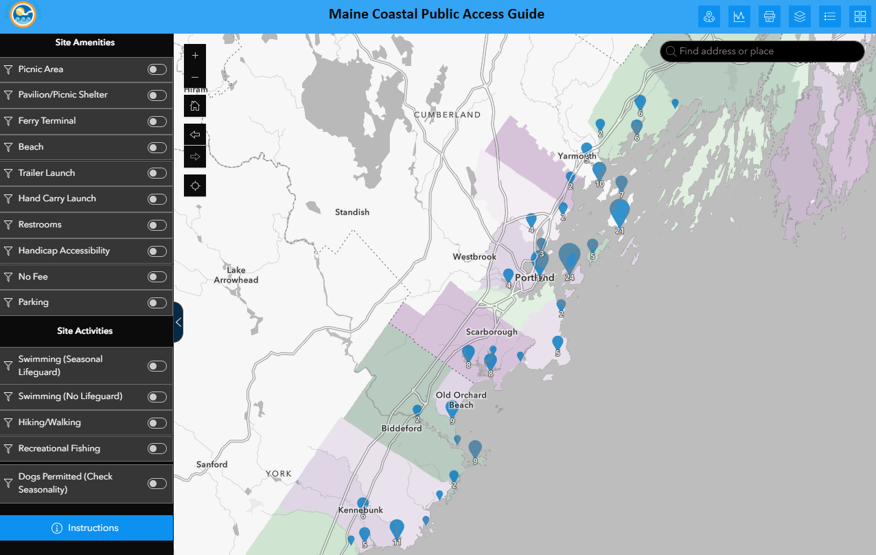
The map contains information about the amenities and uses of each public access site in the listed municipalities. The map can be filtered to show sites fitting different criteria.
The Coastal Zone Map page lists all of the coastal Maine municipalities
Map Information and User Instructions
Note
Disclaimer: While we strive to share accurate and up-to-date information, please be sure to confirm visitation hours and site use rules with the site owner or manager; if you become aware of an inaccuracy, please contact us at the email address below. The information presented here is for informational purposes only and should not be considered legally binding If there is a discrepancy between what is in the guide and local rules, the local rules should be considered accurate.
We have done our best to indicate sites that have some accessible features such as handicap parking or universally accessible trails, but accessibility may vary and we cannot guarantee sites are fully accessible. Please check the site descriptions (in pdfs above and linked in the map) or with site owners/managers for more information.
The guide is still in development. Please contact Melissa at melissa.britsch@maine.gov with questions.
Last update: November 2025
This guide was prepared by Maine Coastal Program under award CZM NA22NOS4190151 & NA21NOS4190064 to the Maine Coastal Program from the National Oceanic and Atmospheric Administration, U.S. Department of Commerce. The statements, findings, conclusions, and recommendations are those of the author(s) and do not necessarily reflect the views of the National Oceanic and Atmospheric Administration or the Department of Commerce.
Acknowledgements
We gratefully acknowledge the many people and organizations who helped provide the data needed to update the guide. We also appreciate our coworkers who provided feedback and assistance throughout the update process.
To cite:
2025 update: Britsch, M. & Nickerson, B. Maine Coastal Public Access Guide (2025 Update). Maine Coastal Program, Maine Department of Marine Resources and Maine Office of Community Affairs, 2025.
Original edition: Noordyk, Julia, ed. Maine Coastal Public Access Guide. Maine: Maine Coastal Program, Maine Department of Agriculture, Conservation and Forestry, 2013.