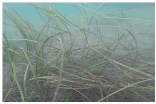
Zostera sp. in Mussel Ridge Channel, Birch Island, Maine, by Colin Faulkingham, summer 2007
Maine's eelgrass meadows form an important marine and estuarine coastal aquatic habitat. Along with other plants, eelgrass forms the base of food production in the sea. Eelgrass provides shelter for juvenile fish, and invertebrates, is a site for primary settlement of the larvae of some bivalve mollusks and invertebrates, and in certain locations helps to stabilize unconsolidated sediments and shorelines.
Maine DMR mapped eelgrass beds in Maine over several surveys in the 1990s and 2000s, the results of which can be viewed on Maine DEP’s Seagrass Coverage viewer along with data from more recent surveys. Since 2013, the Maine Department of Environmental Protection (DEP) has conducted eelgrass surveys in Casco Bay, which culminated in the creation of DEP’s Marine Vegetation Mapping Program (MVMP) in 2023 (38 M.R.S. §1805) with a mandate to map and delineate the extent of seagrass, including eelgrass, throughout Maine every 5 years. More information on Maine Department of Environmental Protection seagrass mapping program can be found here: Monitoring and Assessment of Coastal (Marine) Waters