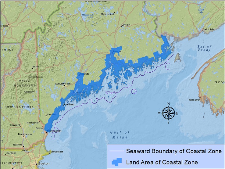
Towns and Townships in Maine's Coastal Zone
- Addison
- Alna
- Arrowsic
- Arundel
- Augusta
- Bangor
- Bar Harbor
- Bath
- Beals
- Belfast
- Biddeford
- Blue Hill
- Boothbay
- Boothbay Harbor
- Bowdoinham
- Bradley
- Bremen
- Brewer
- Bristol
- Brooklin
- Brooksville
- Brunswick
- Bucksport
- Calais
- Camden
- Cape Elizabeth
- Castine
- Chebeague Island
- Chelsea
- Cherryfield
- Columbia
- Columbia Falls
- Cranberry Isles
- Criehaven Township
- Cumberland
- Cushing
- Cutler
- Damariscotta
- Deer Isle
- Dennysville
- Dresden
- East Machias
- Eastport
- Eddington
- Edgecomb
- Edmunds Township
- Eliot
- Ellsworth
- Falmouth
- Farmingdale
- Frankfort
- Franklin
- Freeport
- Frenchboro
- Friendship
- Gardiner
- Georgetown
- Gouldsboro
- Hallowell
- Hampden
- Hancock
- Hancock County Island
- Harpswell
- Harrington
- Isle au Haut
- Islesboro
- Jonesboro
- Jonesport
- Kennebunk
- Kennebunkport
- Kittery
- Knox County Island
- Lamoine
- Lincoln County Island
- Lincolnville
- Long Island
- Lubec
- Machias
- Machias Seal Island
- Machiasport
- Marshfield
- Matinicus Isle Plantation
- Milbridge
- Monhegan Island Plantation
- Mount Desert
- Mount Desert Rock
- Muscle Ridge Township
- Newcastle
- Nobleboro
- North Haven
- Northport
- Ogunquit
- Old Orchard Beach
- Orland
- Orono
- Orrington
- Owls Head
- Pembroke
- Penobscot
- Perkins Township, Swan Island
- Perry
- Phippsburg
- Pittston
- Pleasant Point
- Portland
- Prospect
- Randolph
- Richmond
- Robbinston
- Rockland
- Rockport
- Roque Bluffs
- Saco
- Saint George
- Scarborough
- Searsport
- Sedgwick
- Sorrento
- South Berwick
- South Bristol
- South Portland
- South Thomaston
- Southport
- Southwest Harbor
- Steuben
- Stockton Springs
- Stonington
- Sullivan
- Surry
- Swans Island
- T7 SD BPP
- Thomaston
- Topsham
- Tremont
- Trenton
- Trescott Township
- Veazie
- Verona Island
- Vinalhaven
- Waldo County Island
- Waldoboro
- Warren
- Washington County Island
- Wells
- West Bath
- Westport Island
- Whiting
- Winter Harbor
- Winterport
- Wiscasset
- Woolwich
- Yarmouth
- York