The Department of Marine Resources’ (DMR) Division of Marine Mammal Research Passive Acoustic Monitoring (PAM) program aims to increase our understanding of where and when North Atlantic right whales (NARW) occur in the Gulf of Maine to assess where NARWs and fishing gear overlap. This data will then be integrated into risk modeling efforts. This work was made possible by funding from the Consolidated Appropriations Act in 2023.
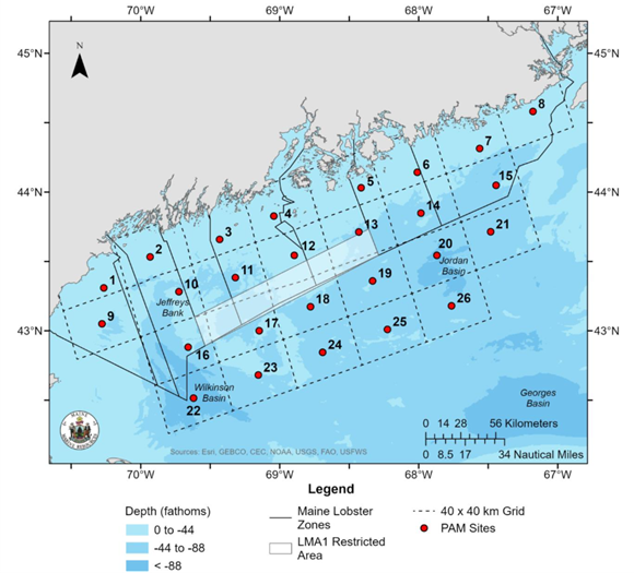
DMR has been collecting continuous acoustic data at 26 sites throughout Maine’s portion of Lobster Management Area 1 (LMA1) and parts of LMA3 since November 2023. Eleven of these sites have been recording since August 2023. Moorings are swapped out, and data are retrieved for analysis every four months.
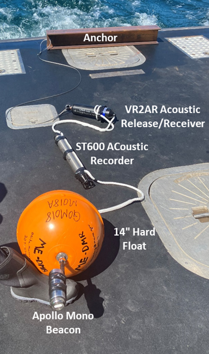
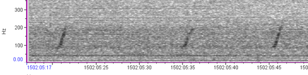
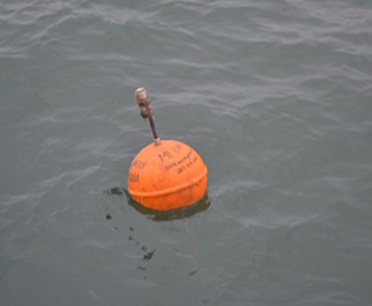
Pictured below is an archival PAM mooring. The 14” hard float provides buoyancy so that once the anchor is released the PAM mooring will float to the surface and DMR can retrieve it. The Apollo Mono beacon sends the latitude and longitude of the PAM mooring via satellite whenever it is at the surface. DMR will use these to track down any PAM moorings including those that may have been dislodged and come to the surface earlier than expected. The ST600 acoustic recorder is the instrument DMR uses to record ocean sounds at each PAM site. DMR reviews these recordings for North Atlantic right whale (NARW) vocalizations, which will indicate whale presence within, on average, a 10-kilometer radius of the PAM site. The VR2AR is an acoustic release and receiver that releases an anchor securing the PAM mooring to the ocean floor so that DMR can retrieve the PAM. The VR2AR release/receiver also detects acoustically tagged fish within a certain distance of the receiver.

Interpreting Passive Acoustic Data
PAM moorings will be swapped out approximately every four months and the data downloaded, processed, and analyzed. Once the acoustic recordings have been analyzed and reviewed by DMR science staff, the NARW acoustic detection data will be uploaded to NOAA Fisheries Northeast Fisheries Science Center’s Passive Acoustic Cetacean Map, a publicly available portal for viewing PAM detections over different periods of time and areas.
For preliminary results on NARW presence in the Gulf of Maine from our PAM data, please read our feature article in Landings : “Update on DMR's Right Whale Passive Acoustic Monitoring”. Additional preliminary PAM data visuals from ME DMR can be found under ‘Program Highlights’.
Due to the January 2025 Jeffrey’s Ledge NARW aggregation and the high NARW vocal activity at nearby PAM site 9, a near-real time acoustic glider was deployed to conduct a targeted survey in the Jeffrey’s Ledge area in mid-December 2025 and will continue recording through the beginning of March 2026. All acoustic whale detections will be uploaded to https://robots4whales.whoi.edu/recent-detections/ and NARW aggregations communicated directly to the fishery.
DMR asks that fisherman voluntarily avoid PAM mooring buffer zone areas to minimize potential gear conflict with PAM moorings to prevent significant data loss and minimize damage to fishing gear. These buffer zones are available for download in a variety of different file formats at the State of Maine's ArcGIS Hub website.
If a harvester accidentally entangles a PAM mooring, please contact PassiveAcoustics.DMR@maine.gov for instructions on returning it to DMR.