The DMR Division of Marine Mammal Research Survey Program conducts visual surveys for North Atlantic right whales from aerial and vessel platforms throughout the Gulf of Maine. The goal of these survey efforts is to increase our understanding of where and when right whales frequent Maine waters. Since July of 2024, monthly aerial and vessel line-transect surveys have been collecting data to estimate the density and abundance of whales. Survey effort and right whale sightings are uploaded on the day following each survey to Whale Map.
DMR surveys are conducted under NMFS Permit No. 27858
Aerial Surveys
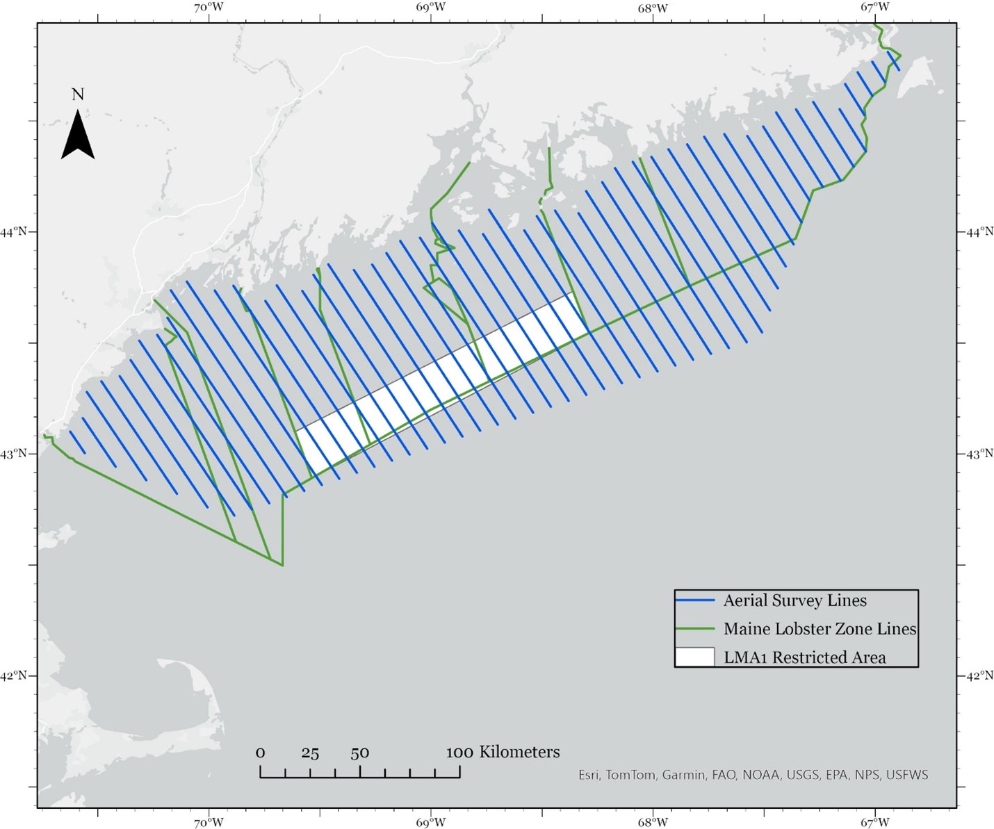
DMR has contracted Azura Consulting LLC. to conduct monthly broad scale aerial line-transect surveys along pre-determined track lines that provide dense visual coverage of Maine’s shoreline out to about 60 nautical miles from shore (see Map). Surveys are flown at a ground speed of 100 knots and an altitude of 1000 ft in a high-wing twin engine Partenavia P68 aircraft. The plane is equipped with bubble windows that afford observers a complete view of the ocean on either side of the plane as well as a window that opens for the photography of marine species.
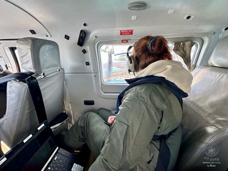
During aerial surveys, two observers are positioned on either side of the plane to record detections of marine species. They use Mysticetus LLC. software to record the effort type (transit, on track, start track, break track, resume track, end track, or off watch), and a GPS is integrated with the program to automatically record date, time, position (latitude and longitude) of the plane, speed over ground, course over ground, and altitude. Observers record environmental variables such as general weather, sighting visibility distance, cloud cover, and sea state on the Beaufort Scale. When marine species are detected, observers record the declination angle of the sighting, which is used to calculate distance from track line to sightings, the species identification, the reliability of that identification (definite, probable or possible), the number of animals and a +/- confidence of that count for groups (example: 20 +/- 5), the direction of travel of the animal or group, and behaviors observed. Data are recorded in accordance with the North Atlantic Right Whale Consortium Database Guidelines.
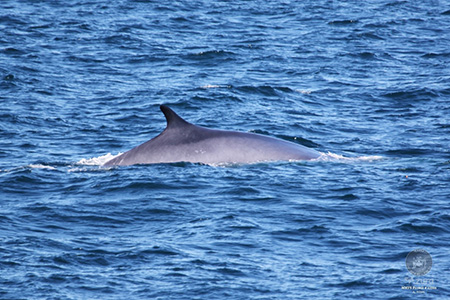
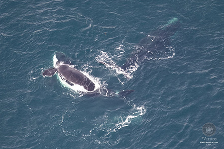
The plane will deviate from pre-determined track lines to confirm the species identifications of large whales and/or to photograph North Atlantic right whales. Observers attempt to photograph the head of each right whale so that it can be matched to an individual in the New England Aquarium North Atlantic Right Whale Catalog.
Vessel Surveys
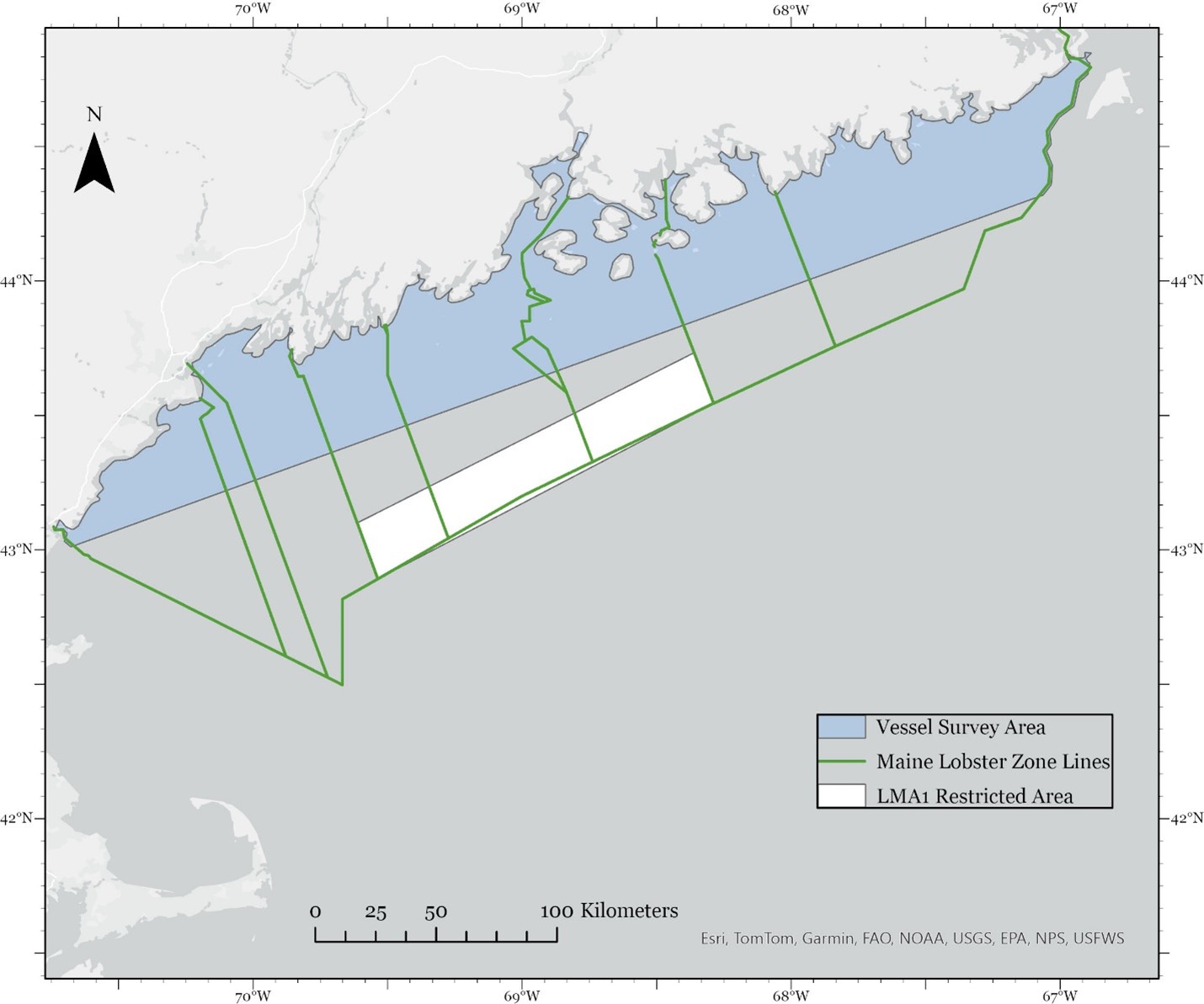
The Survey Program also conducts vessel-based surveys for North Atlantic right whales. These surveys are focused on the area within about 30 nautical miles of the Maine coastline, where the majority of Maine lobster fishing effort is located. Vessel surveys are conducted along predetermined lines inside the blue Vessel Survey Area in the Map.
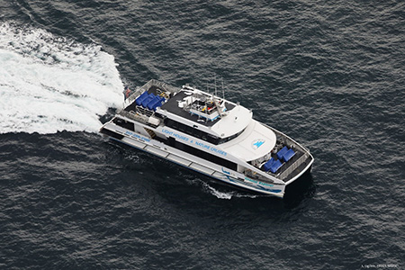
DMR has contracted the Bar Harbor Whale Watch Company to provide a platform for monthly vessel surveys. Their jet-propelled catamarans M/V Acadia Explorer and M/V Coastal Explorer provide observation platforms that are high enough above the surface to observe whales and stable enough to take accurate range measurements. Bar Harbor Whale Watch Company Captains are experienced in maneuvering near whales, providing opportunities for researchers to photograph individuals while minimizing disturbance to the animals.
During vessel surveys, two observers are positioned on either side of the observation deck with binoculars while one observer records data. Observers record the effort type and sightings data, as detailed, above, for aerial surveys. During vessel surveys the range of the sighting location is recorded using reticle binoculars and the relative bearing to the sighting is also recorded.