How to Determine Riparian Landowners: Intertidal Lands
Policy: If the 1,000-foot radius around a proposed lease or the 300-foot radius around an LPA overlaps with intertidal land at mean low water (MLW, 0.0’), the shorefront property owner associated with this intertidal land will receive notification. To ensure consistency, please use the latest version of the NOAA nautical charts as the base map from which to determine the mean low water line. Do not use aerial imagery.
To determine the parcels that should be notified, use the following policy:
(Note: These examples are geared toward leases, which have a 1,000-foot radius for notification. The same policy applies to LPAs, which have a 300-foot radius for notification).
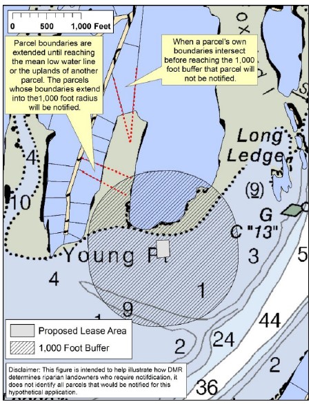
- Riparian parcel lines are extended to the edge of the intertidal on the NOAA chart or the uplands of another parcel. The parcels whose boundaries extend into the 1,000-foot radius around a proposed lease will be notified (Figure 1).
- When a parcel’s own boundaries intersect before reaching the 1,000-foot radius around a proposed lease, the parcel will not be notified (Figure 1).
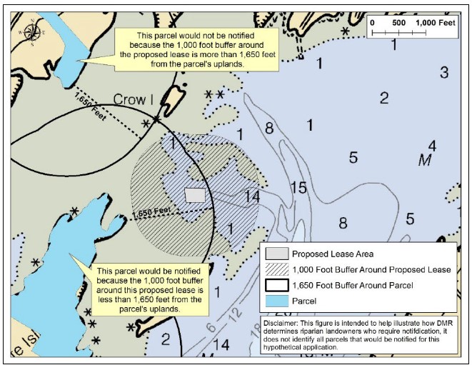
- In areas with extensive tidal flats, the limit of shorefront property ownership extends 1,650 feet into the intertidal from the parcel’s uplands at mean low water (per 12 MRS § 571 and depicted in Figure 2). When the 1,000-foot buffer around a proposed lease is more than 1,650 feet away from a parcel’s uplands, and therefore outside the limits of riparian ownership, the parcel will not receive notification.
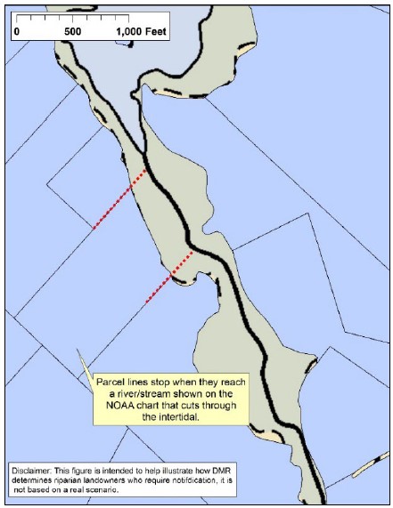
- Parcel lines are assumed to stop when they reach a river/stream shown on the NOAA chart that cuts through the intertidal (Figure 3).
- In cases where it is difficult to determine if a parcel should be notified, DMR/LPA applicants will err on the side of caution and require notification. Failing to provide notice can result in having to start the application process over, which can create significant processing delays.
Riparian Landowners in Unorganized Territory
Aquaculture proposals that are in unorganized territory and need to have a riparian list certified need to contact the Maine Revenue Service, Property Tax Division at: prop.tax@maine.gov or 207-624-5600. The Property Tax Division prefers to be contacted via email.