

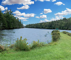
Drinking water sources are vulnerable to contamination whether it be from harmful chemicals or biological organisms (such as bacteria and viruses). Contamination often comes from activities on the land near the source of water. Water systems, no matter how small or large, must produce safe water through a "multiple barrier approach" which includes protecting the source, providing proper disinfection and treatment, cleaning and maintaining water pipes and tanks that carry and store the water after treatment, and monitoring water quality throughout all of those processes. Source protection is the first and most important of these barriers.
Source Water Assessment Program (SWAP)
The Maine Drinking Water Program (DWP) administered the Maine Source Water Assessment Program (SWAP) (PDF), as required under the 1996 Amendments to the Federal Safe Drinking Water Act (SDWA). Under the SWAP, the DWP completed an assessment of the risk of contamination for each public water supply source and published the results for the benefit of the operators of each system and their customers. This work was completed in the early 2000s. The DWP continues to offer drinking water source protection technical assistance to public water systems and their municipalities.
Templates and Guidance
- Best Management Practices for Groundwater Protection (PDF)
- Do's and Don'ts: Protecting Your Wellhead and Drinking Water Supply (PDF)
- Home Heating Oil Tank Replacement (PDF)
- Model Wellhead Protection Ordinance (PDF)
- Source Protection Guide for Public Water Systems (PDF)
- Underground Storage Tanks (USTs) Setbacks (PDF)
- Wellhead Protection Plan Template for Small Water Systems (PDF)
Regulatory Authority
Financial Resources Available
Grants and loans are available to assist public water systems in protecting their drinking water sources.
- Land Acquisition Loans are available for the purchase or legal control of land within a water system's source protection area.
- Source Protection Grants are available for projects that will clearly reduce the likelihood of contamination occurring in a water system's source protection area by existing or future activities.
Maps and Data
Our GIS database helps protect public water sources. This database contains GPS (global positioning system) locations of all public water supply wells and intakes in the State of Maine. A wellhead protection area coverage has also been added. Gravel well delineations and watersheds for surface water supplies will be added as they come available. You can find a list of your county's public water supplies online by clicking here (PDF).
The Maine GeoLibrary also has an internet mapping site where you can find locations of public water supplies in your hometown. Hard copy color maps are also available for municipalities and consultants upon request from Drinking Water Program.
For More Information
To learn more about source water protection, contact Ashley Hodge: Email ashley.hodge@maine.gov or phone (207) 822-2341