DACF Home → Bureaus & Programs → Bureau of Parks and Lands → Paddling Opportunities
Paddling
Paddling adventures are abundant in Maine with
- 3,500+ miles of coastline waters
- 6,000+ lakes and ponds
- Over 31,000 miles of rivers and streams offer meandering flatwater to technical whitewater experiences
- A rich cultural history and beautiful settings
- Ancient interior canoe routes developed by generations of Native Americans
- Coastal town harbors that reflect a heritage of livelihoods drawn from the water; working waterfronts , tall ships, and lobster lore
- Lakes and ponds; some dotted with shoreline camps and homes; others pristine and undeveloped.
What to Expect:
Seasons
- Variable depending on location, elevation, and latitude.
- Ice-free conditions may not exist until mid-late May on mountain and northern lakes; coastal/southern locations are ice-free earlier.
- Cold water temperatures should be expected in all but summer months with very cool ocean temps even in mid-summer.
- Water flow is generally highest during spring-runoff for most waterways; most listed here can also be paddled during the summer and fall when levels tend to be lower.
Safety
- Maine's waters, both coastal and freshwater, are dangerously cold much of the year.
- Ocean tides of as much as 18-25 and strong currents exist at some locations.
- Coastal Paddling Safety tips by the Maine Island Trail Association
- Stay Informed with Safety Updates from the Maine Bureau of Parks and Lands.
- Boating Safety Tips from Maine Inland Fisheries & Wildlife.
- Weather all across the state can rapidly change and winds arise suddenly creating dangerous conditions.
- Personal Flotation Device (PDF)
- Children 10 years of age and under must, by law, wear a Type I, II, or III PFD while on board all watercraft.
- All boaters should wear a PFD at all times in small boats, even if you think you're a strong swimmer.
- Plan and record your route ahead of time
- Notify someone of your intended route and time of return; and monitor conditions carefully.
Courtesy
- Share the boat ramp and docks with other users
- Load your gear out of the way of others who are ready to launch or retrieve
- Launch quickly and safely
Access
- More remote launch sites, especially those on Public Lands and the Allagash Wilderness Waterway and Penobscot River Corridor, may require travel over a network of private logging roads.
- Boat launch use and facilities at Maine State Parks requires paying a day-use fee. Many other public boat launches are free.
Where to go:
(suggested destinations managed by or in partnership with Maine State Parks and Public Lands)
Spend a few hours on the water-
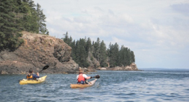
Along the coast:
- Colonial Pemaquid State Historic Site - Home to Native Americans dating back at least one thousand years, Colonial Pemaquid later became the site of a very early English outpost and fishing station. A paved, all-tide boat ramp is available for launching kayaks into the mouth of the Pemaquid River.
- Lamoine State Park - This campground parks central location is a quiet alternative that provides easy access to Bar Harbor, Acadia National Park, rockbound islands, and area lighthouses. A paved boat ramp provides access to Eastern Bay above Mount Desert Island. Take note that the waters off Lamoine State Park can be dangerous and only prepared experienced paddlers should use this area.
- Roque Bluffs State Park - Located in Downeast Maine south of Machias, the park offers both freshwater and coastal paddling in addition to a beach and trails. Beautiful Englishman Bay and 60-acre Simpson Pond can be explored by canoe or kayak (rental kayaks available for use on Simpson Pond).
- Cobscook Bay State Park - Cobscook Bay State Park is a great basecamp for exploring the more sheltered regions of Cobscook Bay. The bay is a fascinating geological and ecological destination with tremendous scenery and wildlife. However, 18-25 foot tides and very strong currents make it a place to be extremely safety-conscious. Paddlers need to research their route and not exceed their abilities.
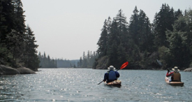
Interior Maine:
- Androscoggin Riverlands State Park - Maine's newest State Park, 2,675-acre Androscoggin Riverlands, lies just north of Lewiston/Auburn and includes 12 miles of river frontage along the Androscoggin River. Brookfield Renewable Energy Partners provides a public boat ramp on the Center Bridge Rd. and there is a hand-carry launch within the park itself. Look for wildlife sightings in numerous coves on Gulf Island Pond, the impoundment in the Androscoggin River formed by Gulf Island Dam south of the park. Picnic sites provided by Brookfield are available on several of the rivers islands.
- Mt. Blue State Park - Mount Blue State Park is a dynamic park in the western Maine Mountains. In total, it encompasses approximately 8,000 acres. The Webb Beach section has 136 wooded camping sites just a short walk from a sandy beach and picnic area. Visitors can swim, launch and rent boats, and walk on trails near scenic Webb Lake (2,146 acres).
- Donnell Pond Public Lands - Donnell Pond Public Lands include more than 14,000 acres of remote forested land with crystal clear lakes, secluded ponds, and mountains with panoramic views. Paddlers can explore this Public Land located in Hancock County between the towns of Franklin and Cherryfield by utilizing boat launch sites on Tunk Lake (Rt. 182, provided by Maine Inland Fisheries and Wildlife), Spring River Lake (Rt. 182, hand-carry), Long Pond (Rt. 182), and Donnell Pond (Donnell Pond Rd, off Rt. 182 in Franklin). Water-access campsites are available.
- Rocky Lake Public Lands - With 11,000 acres of woodlands and wetlands bordering three lakes near East Machias, the Rocky Lake Public Lands provide opportunities for boating, camping and fishing in a wildlife-rich setting. Paddlers can explore Rocky Lake, Second Lake, or both together via Rocky Lake Stream, which connects Rocky Lake, the East Machias River, and Second Lake. Both day trips and overnight excursions are available to paddlers here.
- Chain of Ponds Public Lands - The Chain of Ponds Public Lands near the Quebec border on State Rt. 27 Scenic Byway includes Natanis, Long, Bag, and Lower Ponds joined by short thoroughfares to form the "chain". The property includes frontage on each of the scenic ponds and offers lake shore camping at primitive remote sites, or a privately owned commercial campground with amenities.
- Lily Bay State Park - Located on 75,471-acre Moosehead Lake, the park offers waterfront camping at the gateway to Maine's North Woods. Two boat launch sites are available within the park, enabling exploration of the parks shore as well as nearby 4,208-acre Sugar Island (Maine Public Land). Prepared paddlers with experience on large lakes can explore and camp at numerous locations around the Moosehead Lake Public Lands.
- Duck Lake Public Lands - Located in northern Hancock County about 70 miles northeast of Bangor, the Duck Lake Public Lands comprises more than 27,000 acres of forested land. Duck Lake, the Unknown Lakes, and Gassabias Lake offer paddling opportunities as well as primitive camping.
- Seboeis Public Lands - Paddlers at Seboeis Public Lands enjoy a large expanse of clear water studded by wooded islands and framed in the north by Mt. Katahdin. A boat launch site at the northern end of the Public Land provides access to paddlers and motor boaters alike. A primitive launch site is also available on nearby Endless Lake. Primitive camping is available, with both vehicle and boat-only access sites present.
- Scraggly Lake Public Lands - Situated just northeast of Baxter State Park in northern Penobscot County, Scraggly Lake Public Lands comprises 10,000 acres of gently rolling, heavily forested land centered on 836-acre Scraggly Lake. The lake has a campground and boat launch site on the southeast shore and several attractive, remote campsites accessed from the water.
- Deboullie Public Lands - The 21,871-acre Deboullie property encompasses 17 ponds ranging in size from 8 to 341 acres. Deboullie lies in northernmost Maine, east of the Allagash Wilderness Waterway and 30 miles from the Canadian border. Seven boat launch sites are available for paddlers to access and explore classic north woods ponds.
Extended Backcountry Trips-
- Allagash Wilderness Waterway - Established by the Maine State Legislature in 1966 and designated by the U.S. Department of the Interior in 1970 as the first state-administered component of the National Wild and Scenic River System, the 92-mile Allagash Wilderness Waterway in northern Maine is one of Americas preeminent canoe trips.
- Penobscot River Corridor - Located in the heart of Maine's undeveloped forest land and including 67 miles of river and 70 miles of lake frontage, the Penobscot River Corridor (PRC) provides outstanding opportunities for remote canoe trips, fishing excursions, and whitewater rafting (provided by commercial operators).
- Moose River Bow Trip (Holeb Public Lands) - The 34-mile circuit encompassing Attean and Holeb Ponds as well as the Moose River is a classic northwoods paddling destination in the headwaters of Moosehead Lake and the Kennebec River. Wildlife and mountain views are common sights along this remote paddling route. Description and map of the Moose River Bow Trip on Maine Trail Finder.
- Northern Forest Canoe Trail - Fully half of the Northern Forest Canoe Trail from Old Forge, NY to Fort Kent, ME is in Maine. Richardson Lake Public Lands, the Bigelow Preserve, Moosehead Shoreline Public Lands, the Penobscot River Corridor, and the Allagash Wilderness Waterway are all Bureau of Parks and Lands properties along this ancient canoe route.
- Maine Island Trail - Americas first water trail, the Maine Island Trail is a water trail spanning wild islands and coastal sites along the entire Maine coast. Of the nearly 200 islands along the trail, over 40 are owned by the Maine Bureau of Parks and Lands. The trail is managed by the Maine Island Trail Association.
- St. Croix International Waterway - Managed by the St. Croix International Waterway Commission, the St. Croix is a storied paddling destination along the Maine-New Brunswick border.