
Maine's Roadway Inventories, Classifications, Route Numbers, & Urban Compacts
The MaineDOT Map Viewer
A great way to easily create your own maps, see road classifications and urban compact areas, DOT projects, bridges, and much more!
Having an accurate public road inventory is important for all 488 organized towns, cities, and plantations plus three Indian Nations, and 10 of Maine’s 16 counties. This road inventory directly affects:
- Local Road Assistance Program (formerly URIP) payment amounts from MaineDOT
- Road maps from DOT and E-911 offices because they will be more up-to-date and accurate
- Staff time of municipal and state employees
- Emergency service response
Since the early '80’s, MaineDOT had been active in soliciting towns for changes in their local road inventories
as new roads were built or extended, or roads were discontinued/abandoned, or the number of lanes changed.
We would typically review about 125 towns/cities per year so most communities were reviewed over a 4 to 5 year
We would typically review about 125 towns/cities per year so most communities were reviewed over a 4 to 5 year
cycle. Over 125 maps were generated every year, mailed, edited by town officials, returned to DOT, analyzed
for changes, and then entered into the inventory system. This process was very labor-intensive.
At the same time, the E-911 office of the PUC (formerly with MeGIS) would receive road updates from town/city
addressing officers which may or may not have coincided with information sent to DOT.
That system has now changed so that all changes will be submitted by municipal addressing officers and go
to one state agency (E-911 Bureau) which will then forward that info directly to MaineDOT mapping folks.
- This eliminates the longtime practice of reporting changes to both DOT and E-911 from different (or the same) town officials.
- Each town can now report road information directly to E-911 with ALL road changes (public & private 911 roads). No need to send changes to DOT anymore.
- Addressing officers will be the conduit to report road changes to the state (E-911) at any time of year. DOT will automatically get the public road information needed for LRAP.
As of January 1, 2015, the E-911 Bureau has implemented an online change process rather than using paper forms
that had to be submitted to them for changes. The Bureau also completed many, many training sessions
for local addressing officers on their new system. This system now allows registered addressing officers to
go in and make all road updates to online maps with some simple tools rather than filling out paper forms.
For details on that process, contact the 911 Bureau. If a town does not have computer access, then the Bureau will still take
paper changes request forms from towns.
For questions, contact Peter Coughlan at 207-624-3266 or by peter.coughlan@maine.gov
Federal Highway System (National Highway System)
- The National Highway System consists of roadways important to the nation's economy, defense, and mobility. The NHS was developed by the Department of Transportation (DOT) in cooperation with the states, local officials, and metropolitan planning organizations (MPOs). The system in Maine generally includes includes the Interstate highway system plus “other principal arterials,” plus our intermodal connectors. A listing of all official NHS roads plus the intermodal connectors can be found at the FHWA website.
- These highways must be designated by MaineDOT's Commissioner and approved by FHWA and they are eligible for
federal funding from Maine's NHS allotment:
- NHS- interstate highways designated Interstate Highways. All interstate highways are on the National Highway System. Maine interstate highways are I-95, I-195, I-295 and I-395. Currently there are 367 miles of this category.
- NHS highways that have a federal functional classification of other principal arterial or principal arterial (other freeways or expressways) that are designated by MaineDOT's Commissioner and approved by FHWA and Congress. Currently there are 904 miles of this category.
- NHS intermodal connectors have a federal functional classification of major collector or higher, are designated by MaineDOT's Commissioner and approved by FHWA. Currently there are 23 miles of this category.
- FA-NON-NHS highways that have a federal functional classification of Major Collector or higher and are not on the NHS-Interstate of NHS systems. These highways are eligible for federal highway funds from the Surface Transportation Program, a collection of federal funding sources. Currently there are 5,022 miles of this category.
- NON-FEDERAL highways that have a federal functional classification of minor collector and local. Currently there are 16,484 miles of this category.
State Highway System
- State Highway (SH): A system of connected main highways throughout the state that primarily serve arterial or through traffic. With the exception of urban compact areas, state highways are mostly maintained by the MaineDOT.
- State Aid Highways (SA): Those highways not included in the system of the state highways that primarily serve as collector and feeder routes connecting local service roads to the arterial state highway system. Generally, state-aid highways in the rural area are maintained by the MaineDOT in the summer and by the town in the winter. Any state-aid highways in the urban compact area are maintained by the town.
- Townways (TW): All other highways not included in the state highways and state-aid highway systems, which are maintained by the towns/cities/counties and primarily serve as local service roads providing access to adjacent land.
In Maine, there are two route numbering systems used on thousands of miles of public roads. One is the US route numbering system and the second is the state route numbering system. These numbered routes exist on the federal and state highway systems with a couple of minor exceptions. However, not all state roads have a route number on them.
US Route Numbering System
The US route numbering system primarily exists on the National Highway System (NHS) and other arterial highways in Maine. They are governed by the American Association of State Highway Transportation Officials (AASHTO).
- Criteria for establishment of a US route designation (PDF)
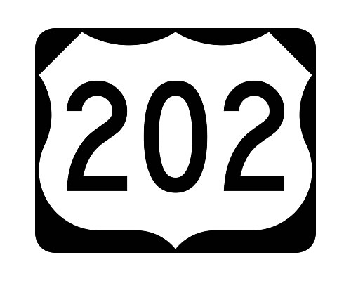
- Example of US route numbering sign (JPEG)
- Current US/State Route Numbers in Maine (PDF)
State Route Numbering System
The State route numbering system exists on many other miles of arterials and collector roads across the state. They are governed solely by MaineDOT. The current system has evolved over many decades and there are many overlaps and redundancies across the system. Some roads have one number on them while others may have up to four numbers simply because they intersect as they pass through Maine towns and cities. Whenever a change is needed on these routes, MaineDOT reviews the criteria for route numbering, accepts public comment, and makes a decision that provides the shortest, most direct path to the traveling public. Signs are typically a black number on a white background on a rectangular sheet.
Maine’s Urban Compact Municipalities are those in which the population according to the last US census:
- Exceeds 7,500 inhabitants, or
- Is fewer than 7,500 inhabitants but more than 2,499 inhabitants, and in which the ratio of people whose place of employment is in a given municipality to employed people residing in that same municipality is 1.0 or greater, and when the municipality has not exercised the opt-out provision of this section.
"Compact" or "built-up sections" mean a section of the highway where structures are nearer than 200 feet apart for a distance of 1/4 of a mile, unless otherwise defined; reference MRSA 23 sub-section 754 , revised July 1, 1999. State Rule Chapter 110 also provides guidance on establishing the compact boundaries.
Presently there are 51 State Urban Compact municipalities. The data from the 2020 US census created four additional towns (Berwick, South Berwick, Cumberland, and Hampden) that became compact on July 1, 2023 because of population numbers over 7500. Pursuant to state law, each of these 51 municipalities has maintenance responsibilities within its defined compact areas.
The State Urban Compact areas that meet one of the two definitions noted above. To view the latest state urban
compact boundary description, click on the municipality's name listed below:
Auburn | Augusta | Bangor | Bath
| Berwick
|Biddeford | Brewer | Brunswick | Buxton | Caribou
Cape Elizabeth |
Cumberland
| Ellsworth | Falmouth | Freeport | Gorham | Gray | Hampden | Kennebunk | Kittery | Lewiston
Lisbon | Old Orchard Beach | Old Town | Orono | Portland | Presque Isle | Rockland | Saco |
Sanford | Scarborough | Skowhegan | South Berwick | South Portland | Standish | Topsham | Waterboro | Waterville
Westbrook | Wells | Winslow | Windham | Yarmouth | York
State Urban Compact areas with a population of over 6,000, but fewer than 7,500 that did not have the opt-out option in 1999:
Belfast | Fairfield | Farmington | Gardiner | Houlton | Millinocket | Rumford
Winter Compact State Highway Municipalities
Any municipality eligible to be an urban compact municipality, that had compact area state highway winter maintenance responsibilities on January 1, 1999, and that has opted out of summer maintenance responsibilities. These municipalities have winter maintenance responsibilities on compact areas of state highways.
Bar Harbor | Bridgton | Bucksport | Calais | Camden | Dexter | Dover-Foxcroft
Fort Kent | Jay | Lincoln | Madawaska | Oxford | Pittsfield
Maine Service Centers
These municipalities are those communities where we work, shop, obtain medical care or enjoy a cultural experience. Maine is dependent on the vitality of these urban places for its economic and social well-being. Much more information can be found here.
Note: All files below are PDFs.