
Adapting to climate change
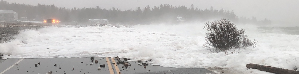
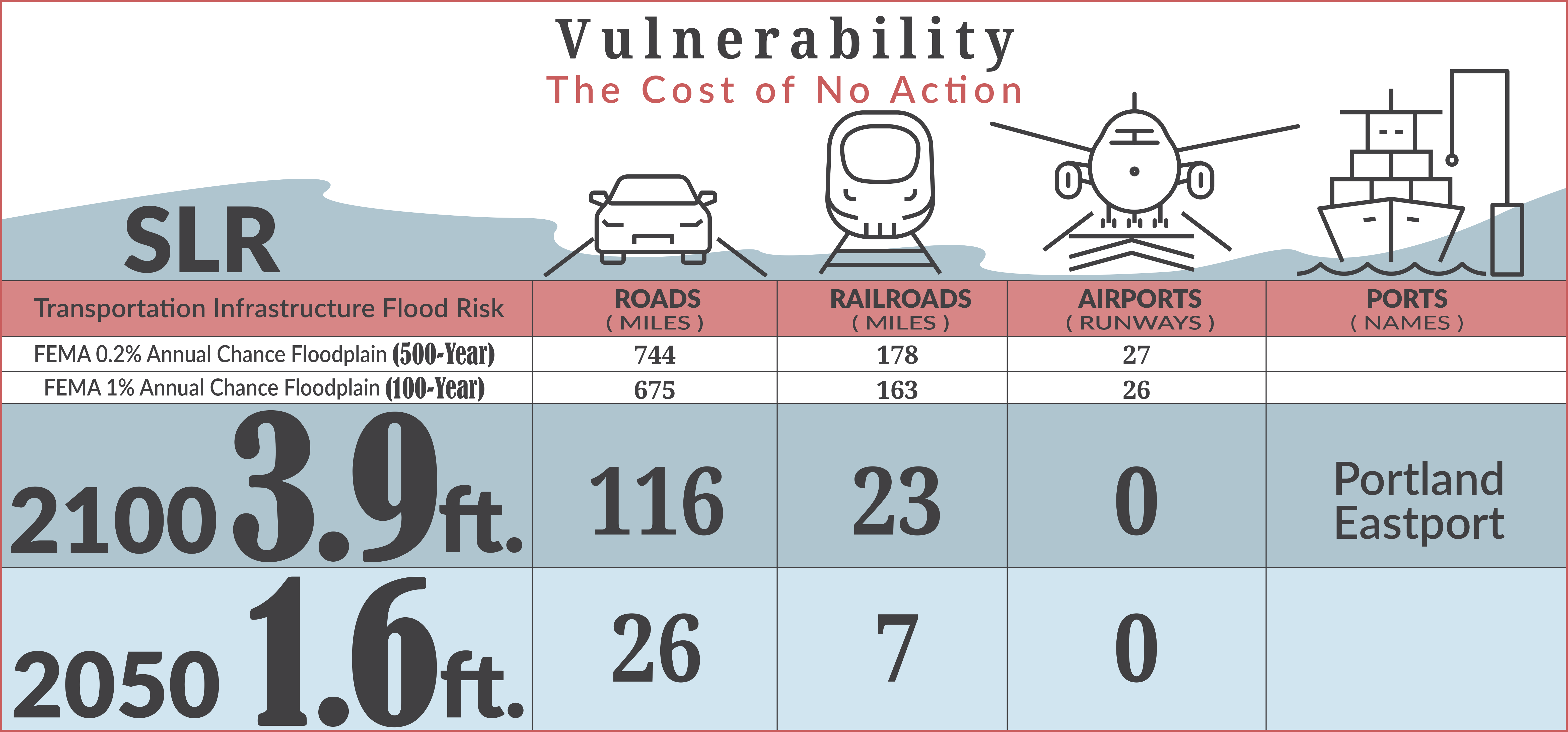
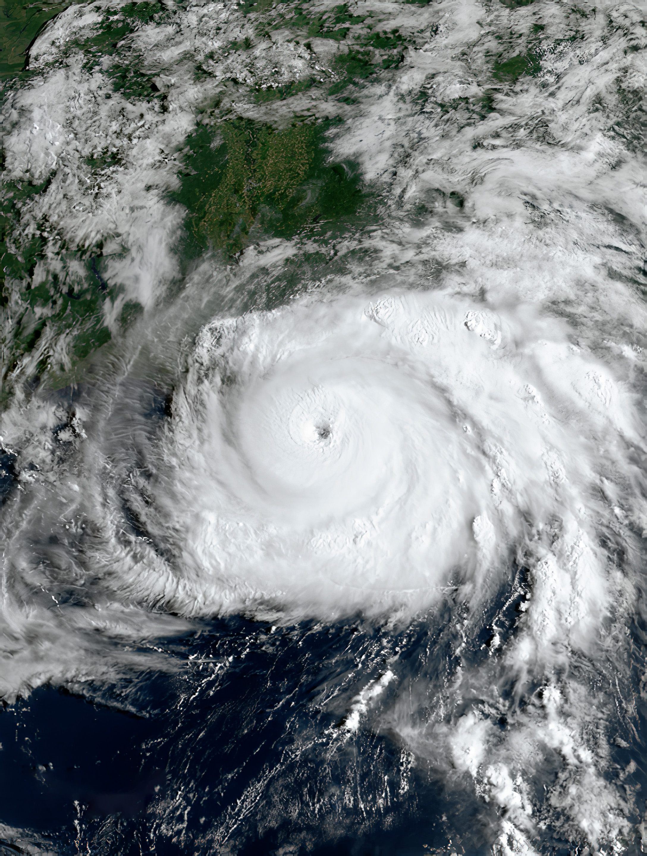
MaineDOT is experiencing the effects of climate change first-hand. In 2022, a number of large storm events resulted in infrastructure failure, causing the roads to be impassible, extended detours, and millions of dollars in damage. As noted in the Maine Climate Council’s Vulnerability Mapping Report, many culverts across the state have a greater than 66% chance of overtopping within the next 30 years (75-year or greater recurrence interval peak flows). Additionally, along the coast, the Maine Climate Council recommends a commitment to manage 1.5 feet of relative sea level rise by 2050 and 3.9 feet of sea level rise by 2100. The data and science to support this recommendation are included in the Scientific Assessment of Climate Change and Its Effects in Maine, which is also available on the Maine Climate Council Website. To lower the risk of future damage to infrastructure, MaineDOT has taken a number of steps to reduce vulnerability to climate change for transportation assets and other infrastructure.


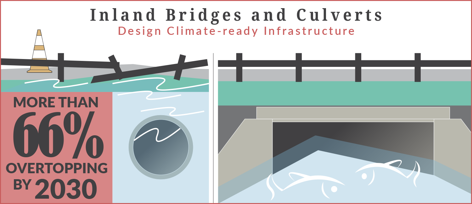
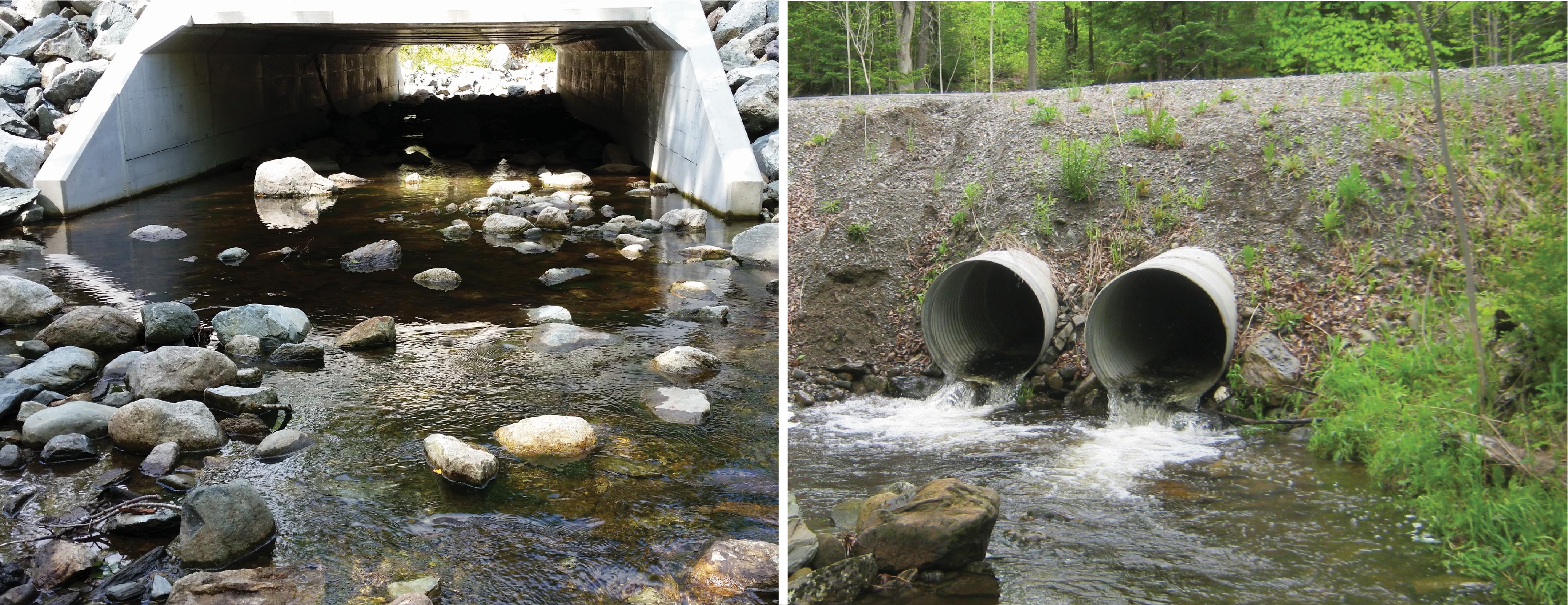
MaineDOT has updated design standards for culverts and bridges to take climate impacts into account. The Bridge Design Guidance was revised to require assessment of 4 feet of sea level rise per 100 years for new bridge designs. The change was based on the National Oceanic and Atmospheric Administration’s (NOAA) historical data for the Maine coast and a range of predictions for future sea level rise, and is consistent with the current recommendations of the Maine Climate Council. Additionally, DOT culverts are now designed for 100-year flow rates; prior design guidance was for the 25-year storm event.
Building on DOT’s work, the state will expand guidance for other agencies. This will include siting and design standards for minimizing climate risks in new facility construction as well as guidance for managing climate risk in existing facilities and assets. Guidance should include consideration of Maine Climate Council’s sea level rise projections and other available climate hazard data.
MaineDOT has identified 7 segments of road as particularly vulnerable to flooding during storm events and/or sea level rise:
- Route 175, Blue Hill
- US 1, Scarborough
- Route 9, Scarborough
- Route 15, Deer Isle
- Route 127, Arrowsic
- Route 209, Phippsburg
- Route 1A, Frankfort
These projects are moving forward with preliminary engineering. Maintenance and Operations reports indicate that flooding already occurs at many of these locations. Flooding is particularly concerning on segments of road that are high priority corridors (HCP 1) with low tolerance for closure due to flooding. HCP 1 roads are critical to the transportation of people, goods, and services throughout the State. These projects will be designed to manage for 1.5 FT of sea level rise (SLR) by 2050 and 3.9 FT of SLR by 2100 to maintain safe passage for the traveling public and the transport of goods and services. These design criteria are consistent with the MCC recommendations.
MaineDOT is working with a consultant, Woods Hole Group, to develop a high-resolution, dynamic, and probabilistic model of flood risk along the Maine coast from storm events and projected sea level rise – the Maine Coastal Flood Risk Model (ME-CFRM). The model will take advantage of a new NOAA LiDAR dataset that will provide consistent, high-quality topographic and bathymetric data covering nearly the entire coast of Maine. The LiDAR data is currently being collected and is scheduled to be released by NOAA starting in mid-2023. Preliminary ME-CFRM output is expected to be available beginning in the spring of 2024, with final model results ready to be shared with the public by the fall of 2025.
MaineDOT has hired Climate Advisory LLC to conduct a Statewide Vulnerability Assessment of all assets within the State transportation infrastructure. The Assessment will consider the sensitivity and adaptive capacity of the infrastructure to climate hazards, identify which infrastructure is the most vulnerable, and finally determine the probability and consequence of failure, which will be used to recommend actions and focus areas for the Department. This effort will consider the other initiative pursued by the state, federal, and municipal levels. The assessment results and methods will be made publicly-available so that others can utilize and replicate the work. The Assessment will support the State’s climate action plan and lead by example efforts, in addition to saving money on future disaster events.
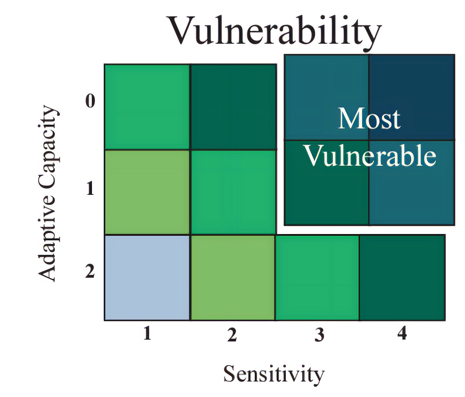
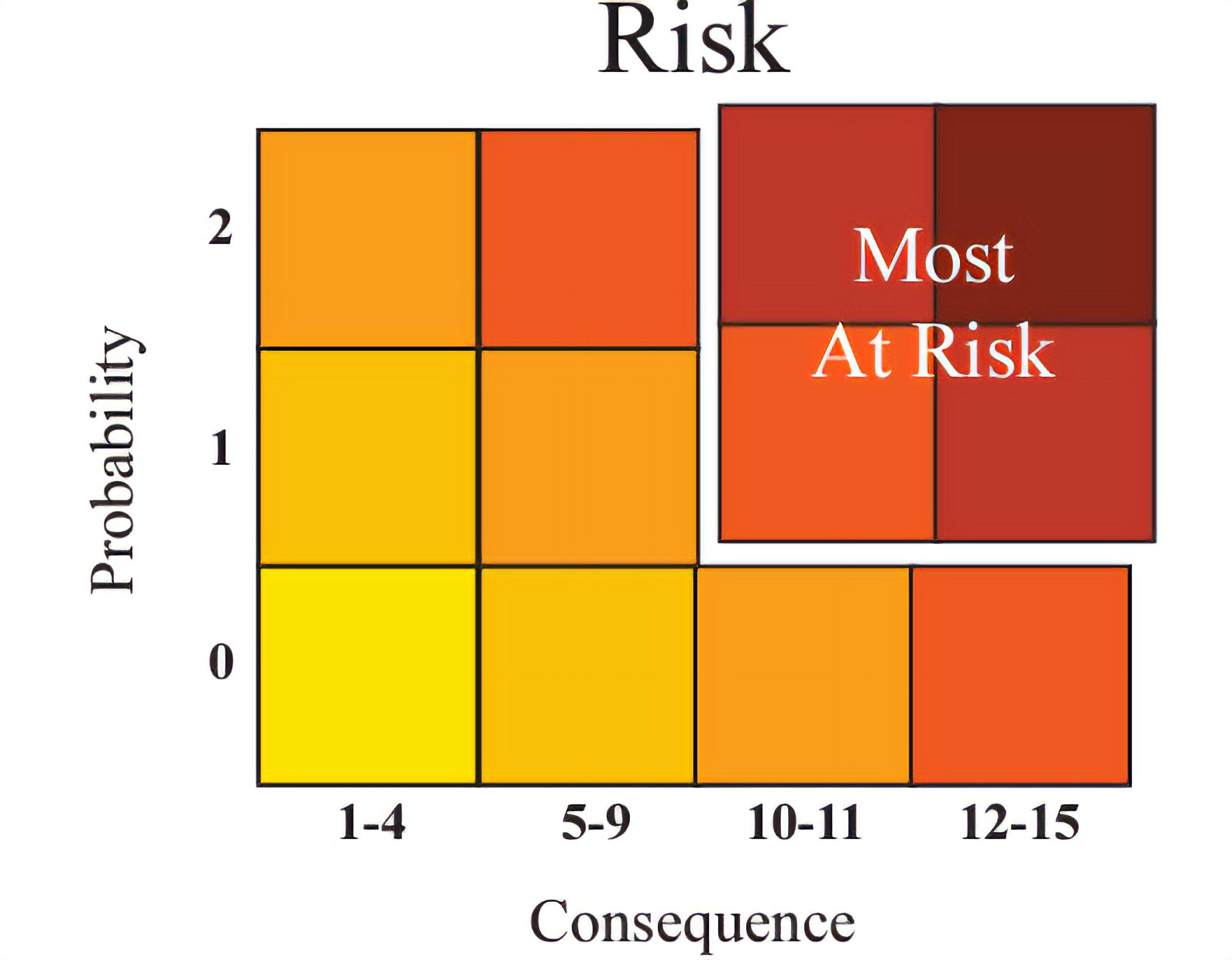
"Vulnerability" and "Risk" images courtesy of City of Somerville CCVA Report, June 2017
- MaineDOT administers the Municipal Stream Crossing Program and the Maine Infrastructure Adaptation Fund. In February 2024, MaineDOT awarded $1.4 million in grants to 19 communities in Maine under the Maine Infrastructure Adaptation Fund and $4 million in grants to 18 communities under the Municipal Stream Crossing Program. See Press Release for more information. Future funding opportunities for these programs will be posted on MaineDOT’s grants website.
- Maine Communities have access to grants and direct support for reducing emissions and preparing for the effects of climate change through the Community Resilience Partnership administered by the Governor’s Office of Policy Innovation and the Future.
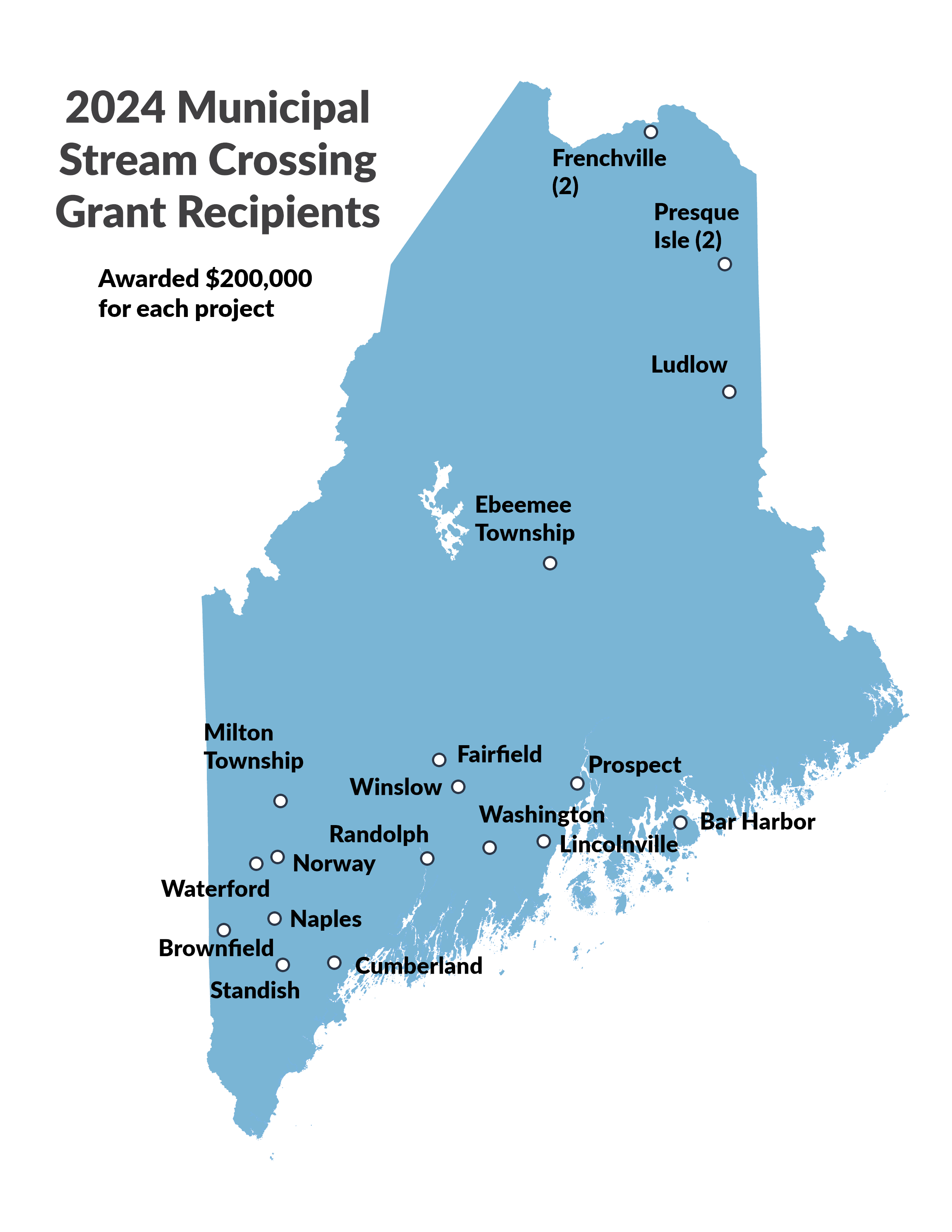
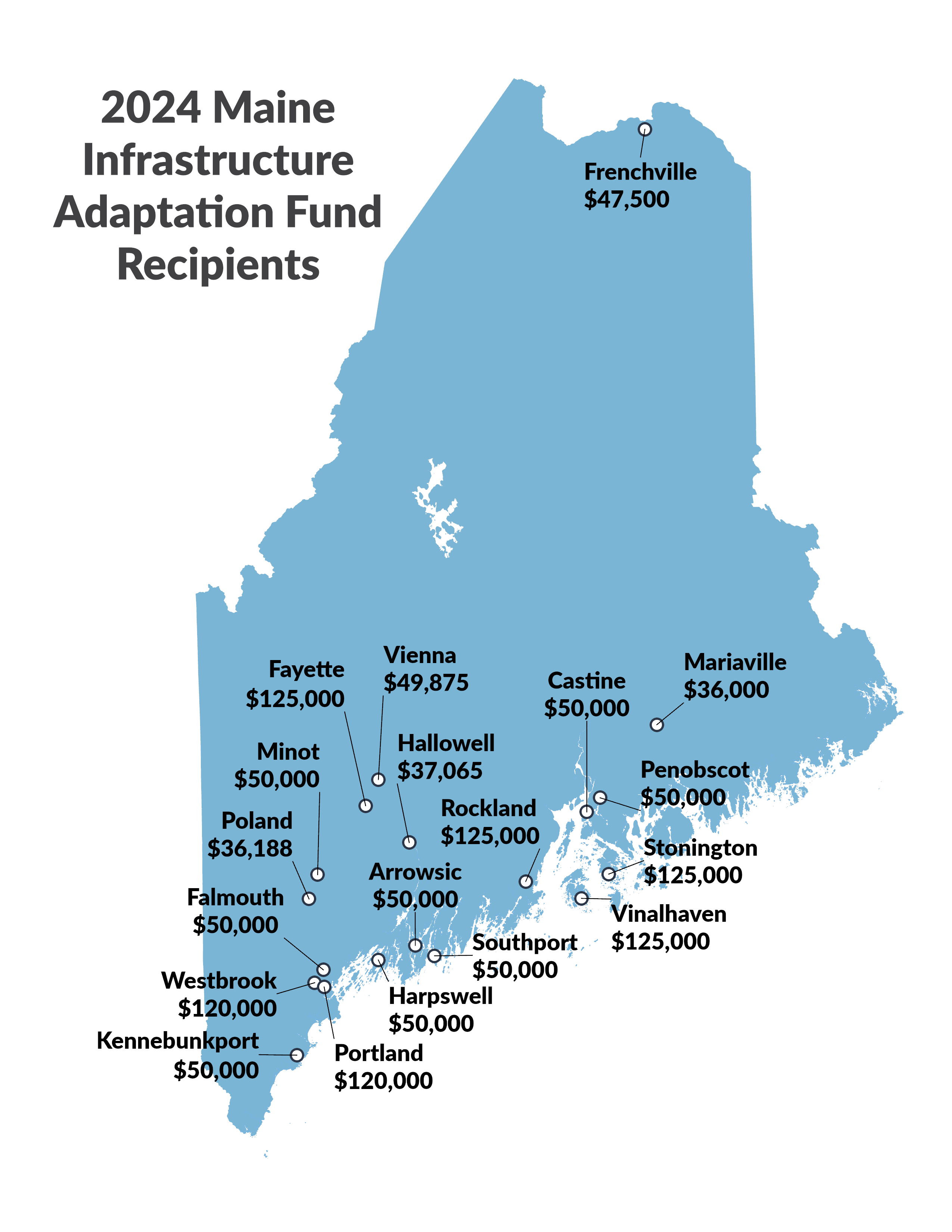 MaineDOT administers the Maine Infrastructure Adaptation Fund, which provides direct funding to public entities to adapt their critical infrastructure to reduce vulnerability to climate change. The Fund, first announced by Governor Mills in December 2021, was a recommendation of the state’s climate action plan, Maine Won’t Wait, to support community efforts to build climate resilience in Maine. Infrastructure Adaptation Fund recipients will use the funds for projects to address flooding along ocean and riverfronts, protect stormwater and wastewater systems, install culverts to reduce flooding; and ensure energy availability during extreme storms. In 2022, MaineDOT awarded nearly $20 million in funds to 12 communities. In 2024, MaineDOT awarded $1.4 million in funds to 19 communities. A full list of the awarded projects is available here.