September 15, 2013 at 1:53 pm
To effectively manage a body of water for a specific species or type of species, fisheries biologists employ multiple survey and study methods to observe the dynamics of that population or species. They use multiple netting techniques during different seasons and target certain species with each study attempt. However, one of the preferred methods of collecting information about a specific fishery is to ask the people with the most recreation time invested using that fishery, the anglers. In my post Spring Fishing Census, I explained about creel surveys, what they are and why we do them. Creel surveys are a great tool to gather information about what species anglers are catching, how many fish they are keeping, and, generally, how healthy the population is. However, creel surveys take a lot of time and provide an overview for only the water on which you are surveying. To get an idea of fishing pressure and trends on multiple bodies of water, biologists take to a slightly different method, aerial surveys.
[caption id="attachment_372" align="alignleft" width="300"]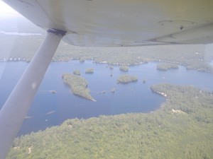 Counting active fishing boats on Little Sebago from the air.[/caption]
To survey multiple fishing destinations quickly and efficiently, fisheries biologists hire a pilot to survey many waters from the air. Using a fixed-wing airplane, the pilot flies a survey route consisting of 30 to 35 waters two days each week (at least one weekday and one weekend day). The pilot begins the route late enough in the morning to give anglers a chance to get out there, but not so late in the day that anglers are leaving the waters. Flying over each pond in turn, the pilot counts how many boats with actively fishing anglers are on the water. In some cases, the distinction between coldwater anglers (folks fishing for salmon and trout) and warmwater anglers (folks fishing for bass, pickerel, perch, etc) is also made in the counts.
For the Sebago Lake Region, the ponds on the aerial survey list include Horne Pond, Otter Pond #2 and #4, Sebago Lake, Little Sebago Lake, Panther Pond, Crystal Lake, Sabbathday Lake, Middle and Upper Range Ponds, Thompson Lake, Pleasant Lake, Auburn Lake, Norway Lake, Hobbs Pond, Keoka Lake, Bear Pond, Kezar Lake, Upper, Middle, and Lower Moose Ponds,
[caption id="attachment_371" align="alignleft" width="300"]
Counting active fishing boats on Little Sebago from the air.[/caption]
To survey multiple fishing destinations quickly and efficiently, fisheries biologists hire a pilot to survey many waters from the air. Using a fixed-wing airplane, the pilot flies a survey route consisting of 30 to 35 waters two days each week (at least one weekday and one weekend day). The pilot begins the route late enough in the morning to give anglers a chance to get out there, but not so late in the day that anglers are leaving the waters. Flying over each pond in turn, the pilot counts how many boats with actively fishing anglers are on the water. In some cases, the distinction between coldwater anglers (folks fishing for salmon and trout) and warmwater anglers (folks fishing for bass, pickerel, perch, etc) is also made in the counts.
For the Sebago Lake Region, the ponds on the aerial survey list include Horne Pond, Otter Pond #2 and #4, Sebago Lake, Little Sebago Lake, Panther Pond, Crystal Lake, Sabbathday Lake, Middle and Upper Range Ponds, Thompson Lake, Pleasant Lake, Auburn Lake, Norway Lake, Hobbs Pond, Keoka Lake, Bear Pond, Kezar Lake, Upper, Middle, and Lower Moose Ponds,
[caption id="attachment_371" align="alignleft" width="300"]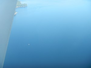 An active fishing boat on Sebago Lake.[/caption]
Sand Pond, Hancock Pond, Peabody Pond, Cold Rain Pond, Trickey Pond, Lond Pond, Symmes Pond, Rock Haven Lake, Great East Lake, Horn Pond, Wilson Lake, Square Pond, Mousam Lake, Little Ossipee Lake, and Lake Arrowhead. On average, it takes about two hours to fly over all of these ponds and count anglers. The information gleaned from these aerial surveys is then used to determine fishing pressure during the open-water and ice fishing seasons on area ponds. This information is used to examine trends in area water use (all seasons), general angler focus (cold water / warm water), and this information can be combined with concurrent creel survey data to estimate total catch and harvest on waters where angler survey data is also collected. All this information helps managers understand angler use patterns and develop management initiatives consistent with angler interests. In some instances regulation adjustment may be considered in response to changes in fishing pressure for instance, if it is determined using aerial surveys that fishing pressure is high (lots of anglers observed) on a given water with a fragile trout population, biologists will begin to plan on other, more specific methods of surveying the trout population in that body of water to be sure the increased fishing pressure is not adversely affecting the trout population. If results from other survey methods show a decline in the trout population, the fishing regulations may be adjusted, reducing the bag limit or increasing minimum length limit, allowing more trout to be left for spawning and renewal of the trout resource in that water.
An active fishing boat on Sebago Lake.[/caption]
Sand Pond, Hancock Pond, Peabody Pond, Cold Rain Pond, Trickey Pond, Lond Pond, Symmes Pond, Rock Haven Lake, Great East Lake, Horn Pond, Wilson Lake, Square Pond, Mousam Lake, Little Ossipee Lake, and Lake Arrowhead. On average, it takes about two hours to fly over all of these ponds and count anglers. The information gleaned from these aerial surveys is then used to determine fishing pressure during the open-water and ice fishing seasons on area ponds. This information is used to examine trends in area water use (all seasons), general angler focus (cold water / warm water), and this information can be combined with concurrent creel survey data to estimate total catch and harvest on waters where angler survey data is also collected. All this information helps managers understand angler use patterns and develop management initiatives consistent with angler interests. In some instances regulation adjustment may be considered in response to changes in fishing pressure for instance, if it is determined using aerial surveys that fishing pressure is high (lots of anglers observed) on a given water with a fragile trout population, biologists will begin to plan on other, more specific methods of surveying the trout population in that body of water to be sure the increased fishing pressure is not adversely affecting the trout population. If results from other survey methods show a decline in the trout population, the fishing regulations may be adjusted, reducing the bag limit or increasing minimum length limit, allowing more trout to be left for spawning and renewal of the trout resource in that water.
 Counting active fishing boats on Little Sebago from the air.[/caption]
To survey multiple fishing destinations quickly and efficiently, fisheries biologists hire a pilot to survey many waters from the air. Using a fixed-wing airplane, the pilot flies a survey route consisting of 30 to 35 waters two days each week (at least one weekday and one weekend day). The pilot begins the route late enough in the morning to give anglers a chance to get out there, but not so late in the day that anglers are leaving the waters. Flying over each pond in turn, the pilot counts how many boats with actively fishing anglers are on the water. In some cases, the distinction between coldwater anglers (folks fishing for salmon and trout) and warmwater anglers (folks fishing for bass, pickerel, perch, etc) is also made in the counts.
For the Sebago Lake Region, the ponds on the aerial survey list include Horne Pond, Otter Pond #2 and #4, Sebago Lake, Little Sebago Lake, Panther Pond, Crystal Lake, Sabbathday Lake, Middle and Upper Range Ponds, Thompson Lake, Pleasant Lake, Auburn Lake, Norway Lake, Hobbs Pond, Keoka Lake, Bear Pond, Kezar Lake, Upper, Middle, and Lower Moose Ponds,
[caption id="attachment_371" align="alignleft" width="300"]
Counting active fishing boats on Little Sebago from the air.[/caption]
To survey multiple fishing destinations quickly and efficiently, fisheries biologists hire a pilot to survey many waters from the air. Using a fixed-wing airplane, the pilot flies a survey route consisting of 30 to 35 waters two days each week (at least one weekday and one weekend day). The pilot begins the route late enough in the morning to give anglers a chance to get out there, but not so late in the day that anglers are leaving the waters. Flying over each pond in turn, the pilot counts how many boats with actively fishing anglers are on the water. In some cases, the distinction between coldwater anglers (folks fishing for salmon and trout) and warmwater anglers (folks fishing for bass, pickerel, perch, etc) is also made in the counts.
For the Sebago Lake Region, the ponds on the aerial survey list include Horne Pond, Otter Pond #2 and #4, Sebago Lake, Little Sebago Lake, Panther Pond, Crystal Lake, Sabbathday Lake, Middle and Upper Range Ponds, Thompson Lake, Pleasant Lake, Auburn Lake, Norway Lake, Hobbs Pond, Keoka Lake, Bear Pond, Kezar Lake, Upper, Middle, and Lower Moose Ponds,
[caption id="attachment_371" align="alignleft" width="300"]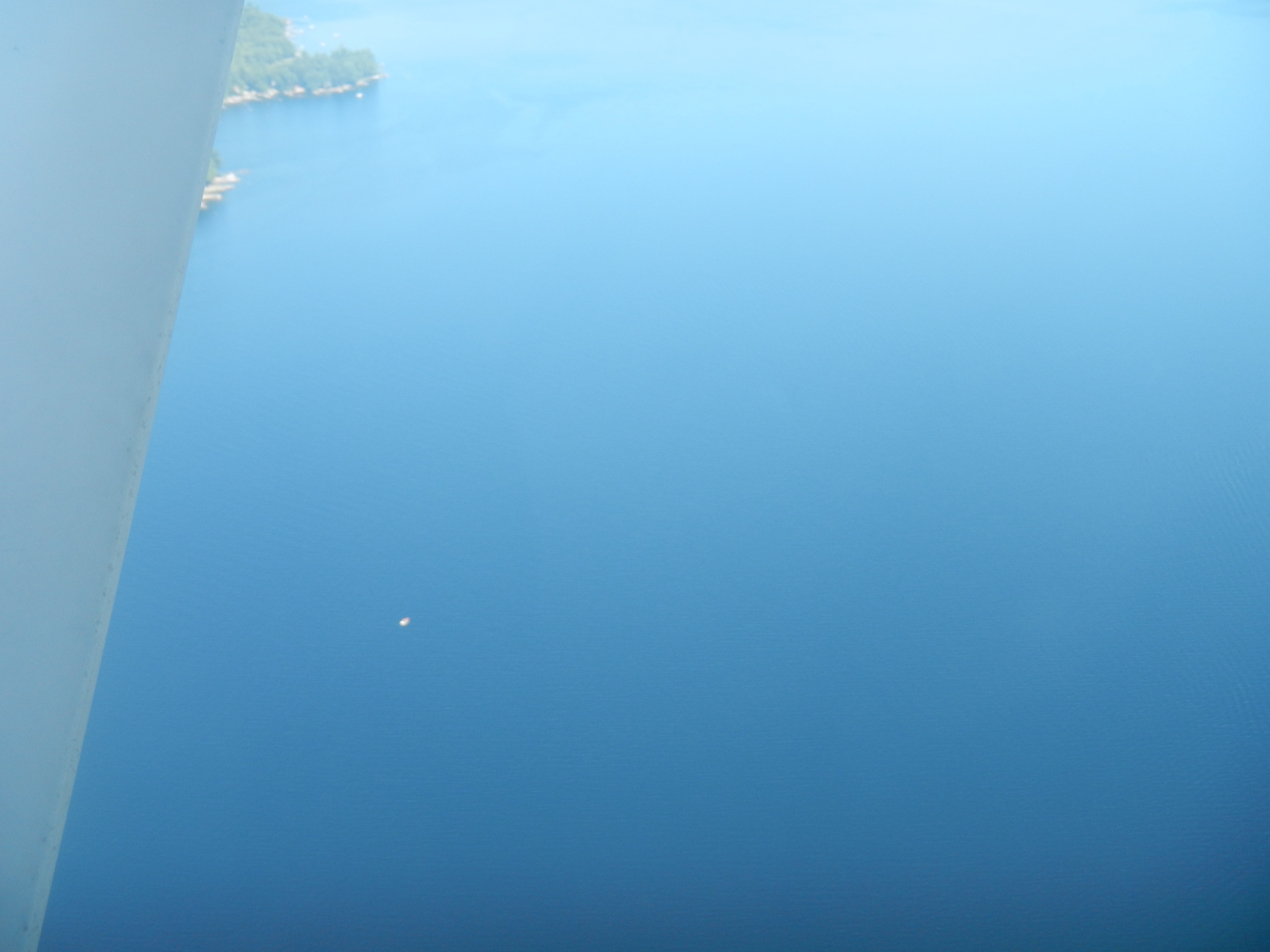 An active fishing boat on Sebago Lake.[/caption]
Sand Pond, Hancock Pond, Peabody Pond, Cold Rain Pond, Trickey Pond, Lond Pond, Symmes Pond, Rock Haven Lake, Great East Lake, Horn Pond, Wilson Lake, Square Pond, Mousam Lake, Little Ossipee Lake, and Lake Arrowhead. On average, it takes about two hours to fly over all of these ponds and count anglers. The information gleaned from these aerial surveys is then used to determine fishing pressure during the open-water and ice fishing seasons on area ponds. This information is used to examine trends in area water use (all seasons), general angler focus (cold water / warm water), and this information can be combined with concurrent creel survey data to estimate total catch and harvest on waters where angler survey data is also collected. All this information helps managers understand angler use patterns and develop management initiatives consistent with angler interests. In some instances regulation adjustment may be considered in response to changes in fishing pressure for instance, if it is determined using aerial surveys that fishing pressure is high (lots of anglers observed) on a given water with a fragile trout population, biologists will begin to plan on other, more specific methods of surveying the trout population in that body of water to be sure the increased fishing pressure is not adversely affecting the trout population. If results from other survey methods show a decline in the trout population, the fishing regulations may be adjusted, reducing the bag limit or increasing minimum length limit, allowing more trout to be left for spawning and renewal of the trout resource in that water.
An active fishing boat on Sebago Lake.[/caption]
Sand Pond, Hancock Pond, Peabody Pond, Cold Rain Pond, Trickey Pond, Lond Pond, Symmes Pond, Rock Haven Lake, Great East Lake, Horn Pond, Wilson Lake, Square Pond, Mousam Lake, Little Ossipee Lake, and Lake Arrowhead. On average, it takes about two hours to fly over all of these ponds and count anglers. The information gleaned from these aerial surveys is then used to determine fishing pressure during the open-water and ice fishing seasons on area ponds. This information is used to examine trends in area water use (all seasons), general angler focus (cold water / warm water), and this information can be combined with concurrent creel survey data to estimate total catch and harvest on waters where angler survey data is also collected. All this information helps managers understand angler use patterns and develop management initiatives consistent with angler interests. In some instances regulation adjustment may be considered in response to changes in fishing pressure for instance, if it is determined using aerial surveys that fishing pressure is high (lots of anglers observed) on a given water with a fragile trout population, biologists will begin to plan on other, more specific methods of surveying the trout population in that body of water to be sure the increased fishing pressure is not adversely affecting the trout population. If results from other survey methods show a decline in the trout population, the fishing regulations may be adjusted, reducing the bag limit or increasing minimum length limit, allowing more trout to be left for spawning and renewal of the trout resource in that water.Categories