Home → Land Resources → OUR SHORE → Issue Profile
Issue Profile
Nature-Based Designs to Shoreline Erosion
Issued: August 2026
Contact: OURSHORE.DEP.@maine.gov
Shoreline erosion in Maine is a growing concern due to storms, flooding, and rising sea levels. Nature-based designs may offer an effective, long-term plan for safeguarding both private and public property against destruction from storms and waves. These designs provide strength, improve the beauty of waterfront properties, and bring a range of benefits to the community and to the health of the environment.
Nature-Based Designs to Shoreline Erosion, also known as "Living Shorelines",
are erosion control practices that incorporate a blend of plants that root into the environment, use biodegradable or other natural materials to help establish plantings, and helping sediment exchange and accumulation which can provide wave attenuation and habitat. As plant communities mature, these designs gain strength, and offer greater resilience over time. Unfortunately, we are learning that rip-rap stone revetments without plants can worsen erosion at neighboring waterfront areas, can get weaker over time, and may not be a resilient solution to erosion.
The “O.U.R. S.H.O.R.E” Program provides guidance and training for installing Nature-Based Designs to protect against shoreline erosion. This program offers detailed how-to information across design best practices and showcases different project examples from throughout the state. Through "O.U.R. S.H.O.R.E," people can:
- Assess sources of erosion,
- Identify design recommendations, and
- Navigate regulatory process to streamline installation of Nature-Based Design practices.
This program serves homeowners, contractors, resource managers, and community leaders, providing them with the necessary support to successfully use Nature-Based Design.
Find Nature Based Designs Quickly!
Nature-Based Designs have a proven track record in Maine, especially along rivers, streams, and lakes. The application of these designs for erosion management is expanding to include estuaries and ocean coasts in Maine where the challenges presented by wave energy, tidal fluctuations, and winter ice can be severe (See Photo 1). Nationwide, Nature-Based Designs are becoming embraced as the most effective plan to address shoreline erosion.
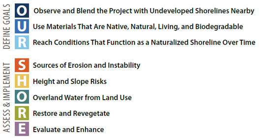
OUR SHORE provides a process for considering all sources of erosion and instability, including overland water from land use, groundwater, saturation, toe erosion, and slope height and steepness. The process focuses on assessing those sources and implementing a site-specific combination of stabilization options that function as a naturalized shoreline The OUR SHORE acronym outlines key elements of the process: defining goals, assessing sources, implementing stabilization options, and evaluating and enhancing the results over time.
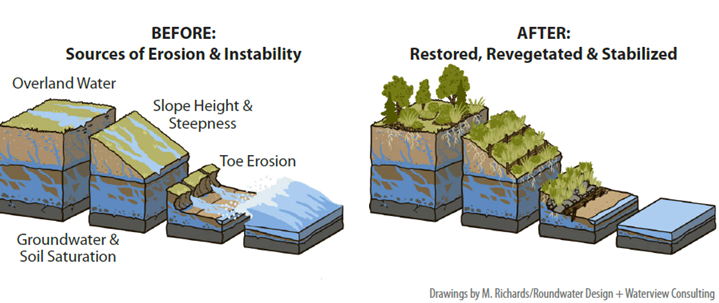
Drawings by M. Richards/Roundwater Design + Waterview Consulting
Rivers and Streams
Rivers and streams have long been focal points for nature-based solutions. These waterways naturally meander, transport sediment, and erode and deposit material along their course. Development along floodplains and the waters edge has restricted the natural dynamic movement of riverbanks creating a hazard for infrastructure, buildings, and communities. Development increases the amount of hard surfaces and makes erosion and flooding worse. By understanding the principles of fluvial geomorphology, which examines the formation and response of river and stream channels to disturbances, we can mimic the natural processes of these waterways using materials such as logs, tree root wads, and boulders for stabilization. Example practices:
- Tree Root Wads are large tree root masses, often with a section of trunk attached, used to dissipate water energy and stabilize banks. Commonly installed as toe protection, flow deflectors, or components of manufactured log jams. The deflectors stick out and create slower moving water at the bank’s toe, diverting higher energy flows away from the bank and creates stabilized, riparian habitat. This design can accumulate sediment and rebuild banks (See Photo 2).
- Brush Mattresses & Stone Toe are dense layers of untrimmed dormant cuttings arranged along eroded or graded slopes and staked firmly in place. Covered with soil and compacted to reduce air pockets and ensure soil contact. Can be used alone or as a living filter layer beneath stone in rooted riprap systems. Living brush will create a dense mat of deeply-stabilizing root systems (See Photo 3).
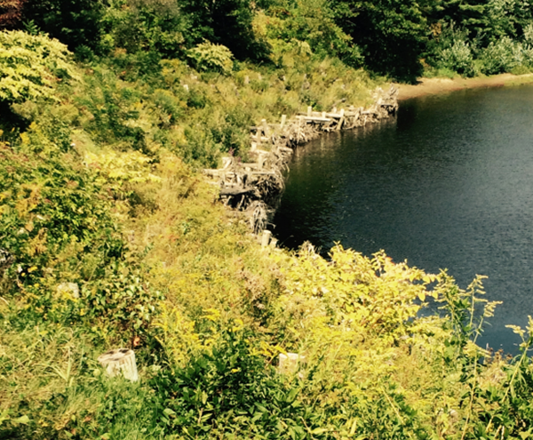
Credit: Maine Department of Transportation
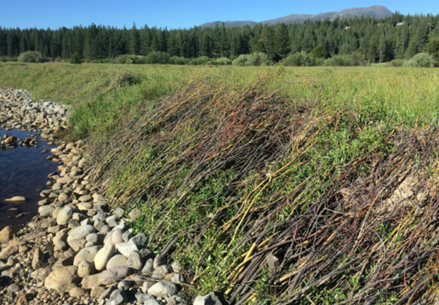
Credit: Wildscape: Upper Truckee River Restoration, Lake Tahoe California
Lakes, Ponds, Freshwater Wetlands
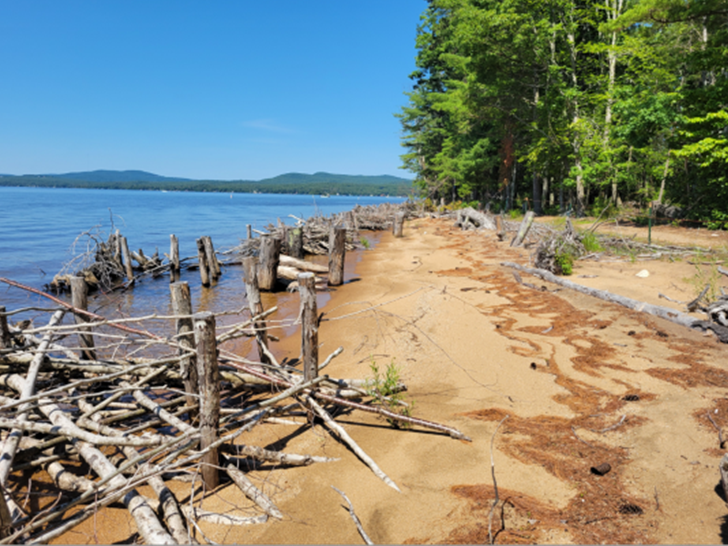
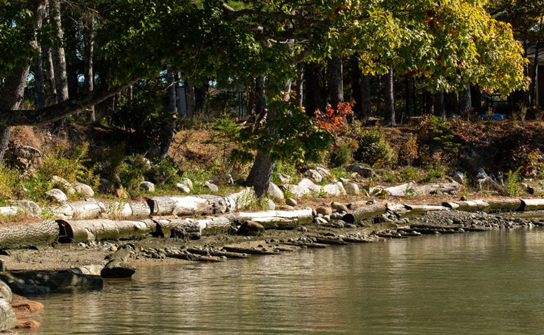
Maine's lakes and ponds have long been sought-after recreation and vacation places and popular residential areas. What were once seasonal cottages have now changed into year-round homes often with grassy lawns leading to the water’s edge, and now visible shoreline erosion caused by the loss of planted buffers and increased boat wakes. Water quality is also made worse by sedimentation and nutrient pollution that can be caused by this kind of development on waterfronts and throughout the watershed. In the past, the go-to solution for lake erosion was the installation of rock riprap, which has since been found to make erosion worse on neighboring shorelines and disrupt vital vegetated habitats. Many modern nature-based stabilization designs for lakes use direct shoreline reinforcement, but often the main cause of weakness comes from land management practices. The OUR SHORE quick assessment checklist for erosion can help when figuring out site conditions and identifying sources of instability, informing effective design practices to create stable shoreline habitats (See Photos 4 and 5). Example practices:
- Live Stakes are cuttings of native plant species with variable sizes from 24 to 36 inches long and one-quarter inch to one inch in diameter that are highly effective at re-rooting when placed in contact with soil. Installed vertically into the soil to grow new plants. Most effective when harvested from species with strong resprouting ability.
- Logs and Posts are untreated logs, posts, and large woody materials used for anchoring, log sills, log cribs, manufactured log jams, log skids, targeted chop-and-drop, and many other applications. Provide structural support and energy dissipation.
Coastal Sand Dunes and Beaches
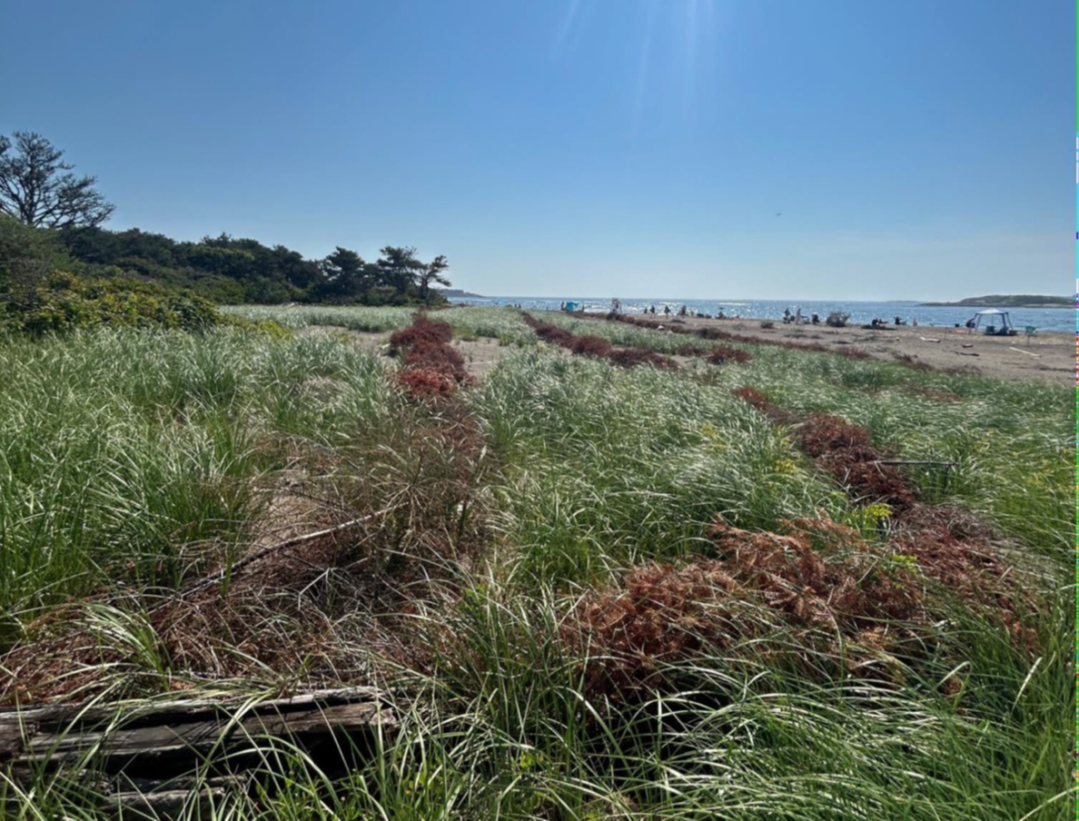
Maine has been working extensively to restore coastal sand dunes in recent years across eleven sites in southern Maine. This effort aims to protect the state's coastal areas from erosion and storm damage, while also preserving the unique ecosystems found in these areas. The restoration work involves planting native beach grasses and other vegetation, and installing sand fencing and other barriers to prevent dune erosion (See Photo 6). Example practice:
- Allow Natural Growth and Regeneration: Increase growth indirectly through thoughtful land use. Buffers will naturally revert over time and are a very cost-effective, low-maintenance option to increase stability. Some enrichment planting can take place to increase biological and structural diversity and other services.
Credit: Maine Geological Survey
Coastal Bluffs, Estuaries, and Coastal Wetlands
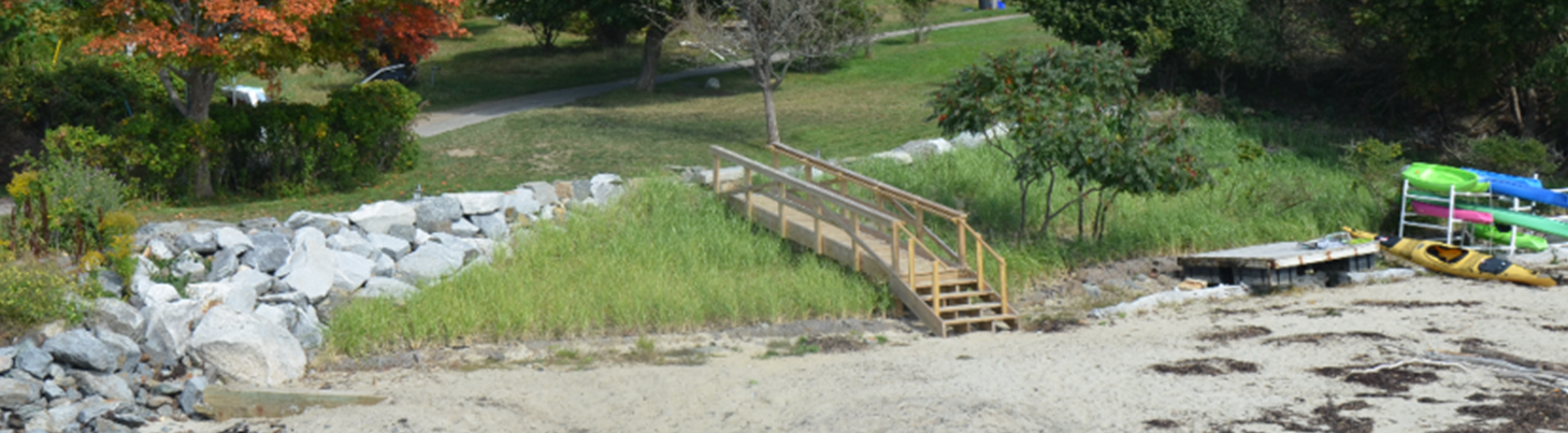
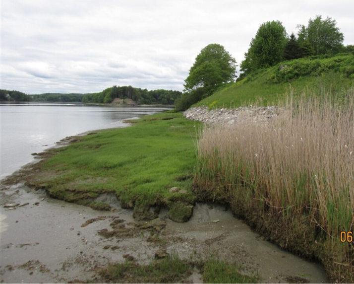
The principles of Nature-Based Solutions for erosion control that have been successfully applied to inland lakes, rivers, streams, and wetlands can also be adapted for Maine's coast wetlands and bluffs. However, coastal erosion control designs must be particularly resilient, incorporating features and vegetation capable of withstanding the salt, waves, and winds characteristic of Maine's coastline, which is frequently battered by ocean storms and tidal fluctuations. There are a growing number of coastal wetland and bluff Nature-Based Design examples currently in Maine that have proved to be resilient in recent storms. Over time, planted slopes are proving to be more robust than relying solely on unplanted rip-rap stone revetments. The benefit of sediment accumulation and exchange that these natural designs provide also reduces erosion on adjacent shorelines. Coastal nature-based erosion control practices encompass regraded and planted slopes featuring a mix of salt-tolerant plant species, adding soil and plantings to existing rip-rap structures, and the use of natural materials typically used in inland erosion control methods, along with bagged or mounded oyster and clam shells. Additional practices for coastal erosion control include wave attenuation devices, the establishment of living breakwaters, and marsh enhancement and creation (See Photo 7 and 8). Example practice:
- Encapsulated Soil is soil contained within heavy fiber blankets, such as coir. Used to form lifts and mats (grow logs). Lifts: Created by layering blanket on bare ground, filling the landward side with a layer of soil, folding the blanket back over that soil, and anchoring with stakes. Encapsulated soil lifts can be an effective way to re-establish vegetated coastal landforms such as the toe of coastal bluffs and salt marshes. Mats (or grow logs): Can be site assembled into “logs” of various diameters and lengths, filled with suitable soil matrix for site- and salinity-specific biome establishment. Can be used in stabilizing marsh and toe of shore where not exposed to strong waves.
Expanding Living Shorelines Implementation in Maine
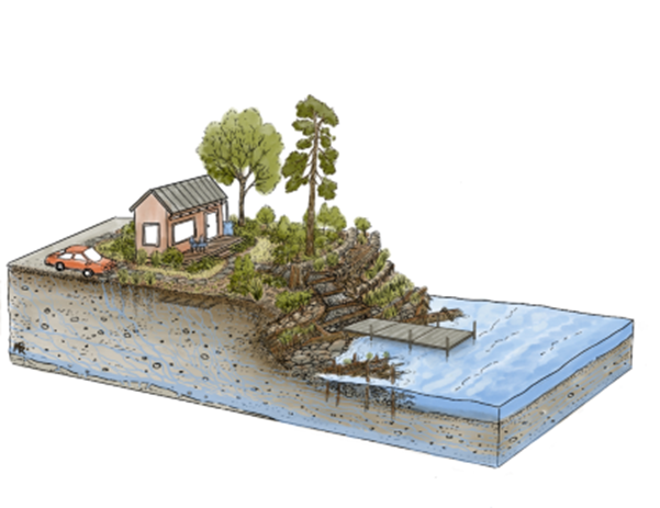
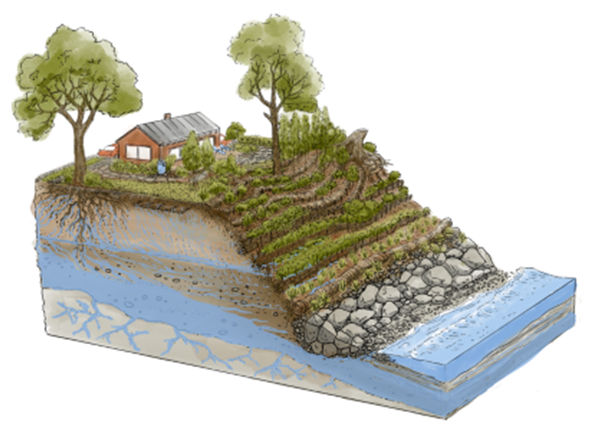
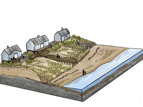
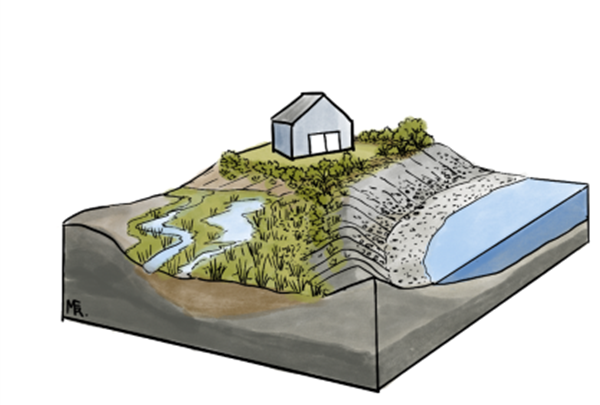
Drawings by M. Richards/Roundwater Design + Waterview Consulting
In Maine, there are extensive miles of unplanted riprap stone revetments, and there are relatively a small, but growing number of coastal living shoreline projects. This opportunity underscores the importance of efforts by the Maine’s Natural Resource Agencies and other partners to provide increased support and guidance for nature-based solutions to address shoreline erosion statewide.
The Maine Department of Environmental Protection, with the Department of Agriculture, Conservation and Forestry, Department of Marine Resources, Department of Inland Fisheries and Wildlife, and other state agency partners, are expanding services to facilitate nature-based designs for shoreline erosion management.
For example, in areas with toe erosion, it is effective to densely plant native species with infilled and planted riprap. stone, with or without upper slope regrading.
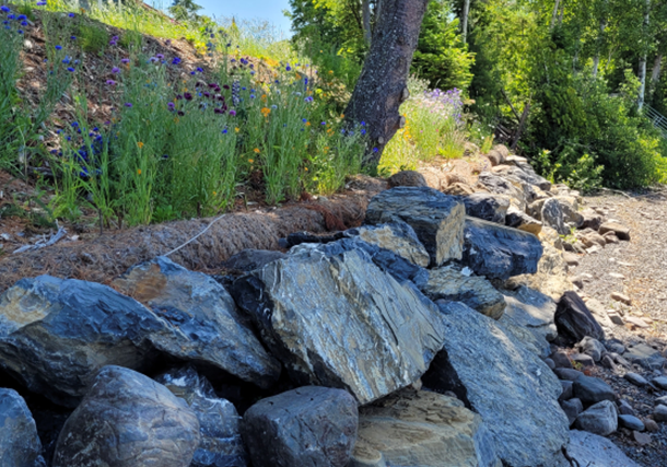
Rooted Riprap uses large angular or subangular stone with a natural filter layer such as crushed stone or brush mattress underneath. Gaps between rocks filled with soil. Plants grow in the soil and are able to extend deep roots through the filter layer (See Photo 9).
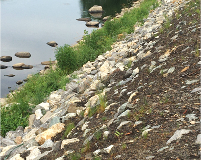
Credit: Maine Department of Transportation
Is a living shoreline a good idea for your property?
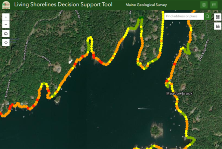
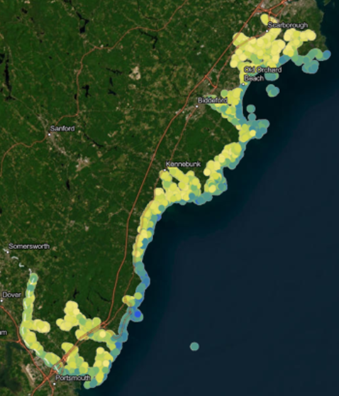
Living Shoreline Suitability decision-support tools are available for much of the coast of Maine (See Figures 2 & 3). Users can assess the potential suitability of a shoreline for nature based design practices based on key factors such as annualized fetch, nearshore bathymetry, shoreline type, aspect, relief, and slope. This information helps shorefront property owners make informed decisions about the most appropriate erosion control strategies, ultimately contributing to environmentally sustainable management of Maine's coastal resources.