DACF Home → Bureaus & Programs → Maine Geological Survey → Maps, Publications and Online Data → Using Geologic Maps → Reading Coastal Sand Dune Geology Maps
Reading Coastal Sand Dune Geology 1:4,800-scale Maps
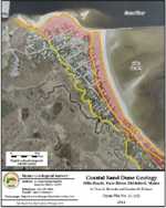
What's on the maps?
These coastal sand dune geology maps delineate the types of dunes that make up the coastal sand dune system. The maps also show erosion hazard areas.
Uses of the maps
Permits are usually required for building projects located in Maine's coastal sand dune system. Such projects are described in the Coastal Sand Dune Rules of the Maine Department of Environmental Protection. The rules are based on the location of the project within the sand dune system. The boundaries shown on these maps provide guidance for interpreting the geology of the dune system with respect to the Sand Dune Rules. The location of the boundaries of the frontal dune (D1), the back dune (D2), and the Erosion Hazard Area (EHA) are especially important in the permit process.
Definitions
Understanding the following terms will help you interpret what you see on a coastal sand dune geology map.
What is a sand dune?
Sand dunes are a landform composed of loose sediment created from the deposition of sand (and sometimes gravel) by waves and wind. Coastal sand dunes form landward of beaches and often have a linear ridge, called a frontal dune, that parallels the beach. Landward of the frontal dune are back dunes or secondary dunes that have a variety of shapes and relief. Back dunes tend to be lower in height than the frontal dune. In some maps in this series, development covers former dunes. The location where the natural dune and coastal processes would exist (absent development) are shown to conform to the regulatory definition in the Coastal Sand Dune Rules.
Maine has a legal definition of a Coastal Sand Dune System that includes sand dunes and is used by the Department of Environmental Protection in the permitting process for development adjacent to beaches. This definition is in Section 480-B(1) of the Natural Resources Protection Act (Title 38 of the Maine Revised Statutes Annotated):
- "Coastal sand dune systems. "Coastal sand dune systems" means sand and gravel deposits within a marine beach system, including, but not limited to, beach berms, frontal dunes, dune ridges, back dunes and other sand and gravel areas deposited by wave or wind action. Coastal sand dune systems may extend into coastal wetlands."
What is erosion?
Erosion is the loss of land due to physical processes such as movement of sediment by waves, coastal flooding, or alongshore currents. Coastal erosion on beaches leads to dune loss, beach elevation changes, and movement of the shoreline over time. Erosion can be short-term, lasting months to a year or it can be long-term lasting years to a century or more. Shorelines along beaches and dunes naturally erode and accrete (gain sand) with the passage of seasons. Seasonal erosion is ususally not a significant concern to the beach and dune system but chronic erosion lasting years to decades can permanently alter the shape of the shoreline, beach, and dunes. Erosion can threaten coastal development by undermining structures or making them more flood-prone. These maps show erosion hazard areas that conform to the regulatory definition in the Coastal Sand Dune Rules.
Refer to the map legend (pdf) for definitions of coastal sand dune environments and erosion hazard areas.
Tips for Reading the Maps
How accurate are the boundaries?
Boundaries on the Coastal Sand Dune Geology Maps were based on existing conditions at the time highly accurate georeferenced air 2018 photos were taken and high-resolution topography from lidar (light detection and ranging), as available.
As possible, fieldwork was completed to confirm revisions of coastal sand dune boundaries. Over 25 years of MGS mapping and internal and external peer-review is represented in the boundaries. The geologic boundaries are estimated to have an accuracy of +/- 10 feet. The boundary of the Erosion Hazard Area is also estimated to have an accuracy of +/- 10 feet.
Additional information on the accuracy of digital sources used can be found in the metadata at the Maine Office of GIS for the 2001 photography with ½-foot pixel resolution and 2003 photography with 1-foot pixel resolution. The 2004 lidar was commissioned by MGS specifically for dune mapping and the topographic metadata is available through the NOAA Coastal Services Center.
Can the location of the boundaries change over time?
The Coastal Sand Dune Geology Map series is accepted by the Maine Department of Environmental Protection (DEP) as the best available information for the permitting process unless an on-site survey and geological analysis indicates otherwise. The intent of the boundaries, as mapped, is to define the long-term position of landforms based on geomorphology even if it experiences short-term erosion or accretion. Dunes that form seaward of the frontal dune ridge crest over a period of a few years are not usually sufficient to warrant a change in the position of the frontal dune or back dune. The Maine Geological Survey does reexamine current field conditions in the review of permits for DEP and has moved a geologic boundary if there is scientific support to warrant such a revision.
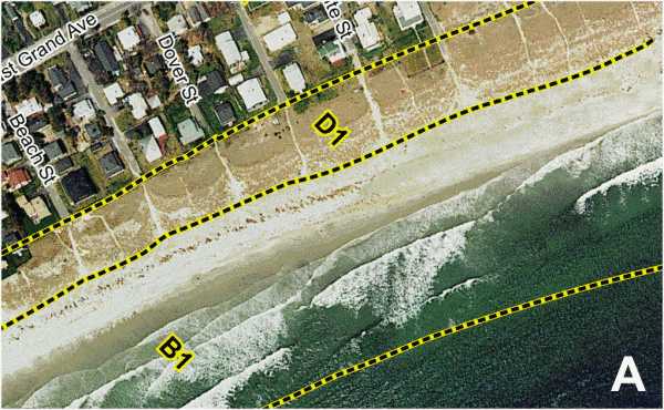
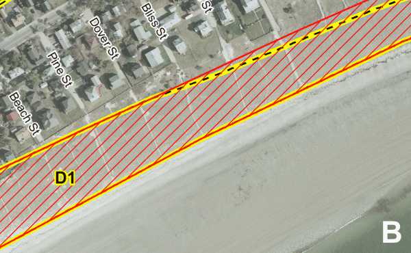
Figure 1. Area where geologic boundaries have changed at Pine Point Beach in Scarborough. A. Superseded Beach and Dune Geology photo published in 2001. B. Current Coastal Sand Dune Geology map of the same area. Erosion Hazard area (EHA) is shown in red.
What are the most sensitive zones with respect to development in the coastal beach and dune system?
All coastal dunes are part of a fragile ecosystem. Many species of dune vegetation are unusual and grow specifically on the unstable sandy environment. This environment can be harsh for many plants because the soil tends to be occasionally inundated by salt water or salt spray and may also experience dry periods and, in places, a low water table. Foot traffic can kill some dune vegetation so sand fencing is sometimes placed around dunes to limit pedestrian access that would destabilize the landform.
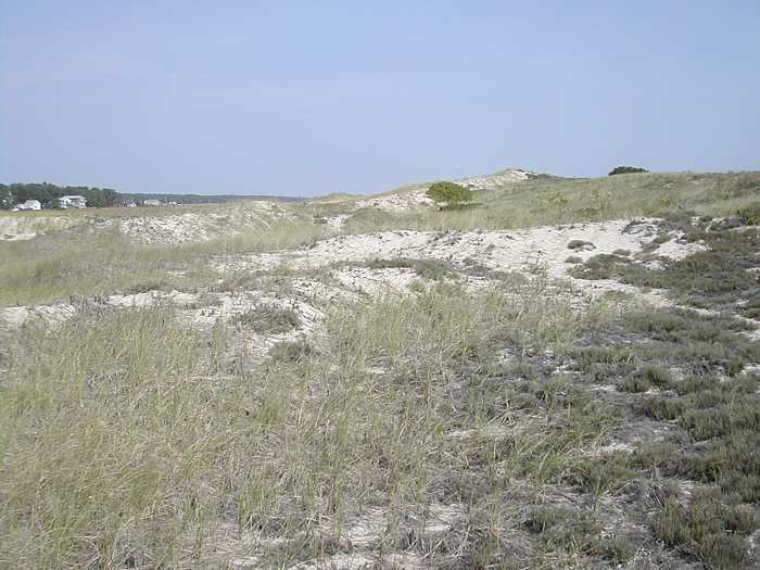
Figure 2. Back dune in Ogunquit.
What are the most dynamic zones with respect to development in the coastal beach and dune system?
Frontal dunes tend to be more dynamic than back dunes. Frontal dunes receive surf and are directly flooded with swiftly moving water in storms. Waves can and do reach the crest of frontal dune ridges. The seaward slope of the frontal dune tends to be the most ephemeral part of the dune system due to periodic erosion. The entire frontal dune may be prone to erosion in a large storm or in a series of small, closely timed storms. A large frontal dune provides protection to the back dune environment during storms. Some back dunes, however, can be flooded from water that rises from a salt marsh or estuarine channel.
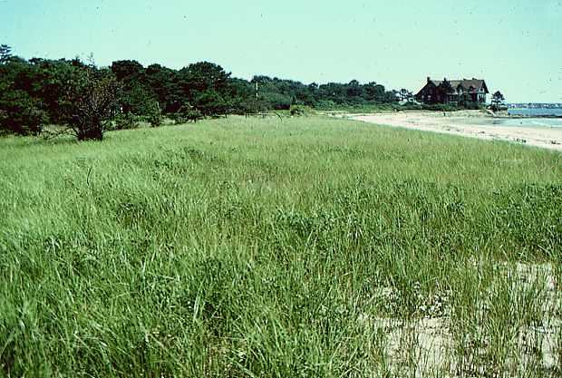
Figure 3. Frontal dune in Parsons Beach.
More Information
For more information on Maine's beaches and dunes, refer to the following pages:
- Maine Coastal Erosion and Hazards - slide show (PDF 1.5MB)
- Coastal Processes and Erosion: The Saco Bay Shoreline - slide show (PDF 2.4MB)
- Maine's Coastal Marine Geology - reports on the state of Maine's beaches and related topics
For further assistance in interpreting this map, contact a geologist at the Maine Geological Survey.
Last updated on February 29, 2016