DACF Home → Bureaus & Programs → Maine Natural Areas Program → Ecological Reserves → Deboullie
(Printer Friendly Version-47 KB pdf) (Download a free copy of Adobe Acrobat Reader)
Deboullie Ecoreserve
T15 R9 WELS
Vital Statistics
- Size: 7,253 acres
- Regulated: 1,086 acres
- Non-Regulated: 6,167 acres
- Upland: 6,213 acres
- Forested Wetland (NWI): 108 acres
- Non-Forested Wetland: 49 acres
- Open Water: 897 acres
- Roads: unimproved-4 miles
- Roads: trails-17 miles
- Roads: Total-21 miles
- Biophysical Region: St. John Uplands
- BPL Region: North
Exemplary Natural Communities
Rare Plants
| Scientific Name | Common Name | State Rank | Global Rank | State Status |
|---|---|---|---|---|
| Juncus alpinoarticulatus | Alpine Rush | S3 | G5T5? | SC |
| Minuartia rubella | Arctic sandwort | S1 | G5 | T |
| Eleocharis quinqueflora | Few-flowered Spikerush | S2 | G5 | SC |
| Dryopteris fragrans | Fragrant Cliff Wood-fern | S3 | G5 | SC |
| Stuckenia filiformis var. alpinus | Northern Slender Pondweed | S2 | G5T5 | SC |
| Woodsia alpina | Northern woodsia | S1 | G4 | T |
| Woodsia glabella | Smooth woodsia | S1 | G5 | T |
Rare Animals
There are no documented occurrences of rare animals within this Ecoreserve. For more information on rare animals in Maine, visit the Maine Department of Inland Fisheries and Wildlife.
Description
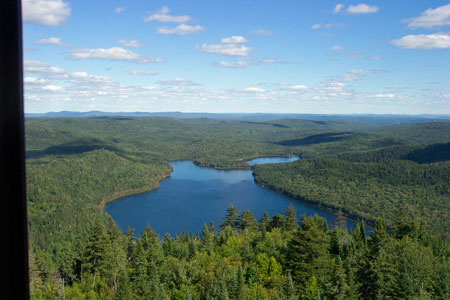
The Deboullie Ecological Reserve is a microcosm of the landscape of northern Aroostook County, with lakes, ponds, low mountains, and stream valleys providing a variety of physical settings. Fire and logging have both played a part in the reserve's history; however, because of steep slopes and lakeshore, much of the reserve has received little cutting in the recent past, with some isolated older stands.
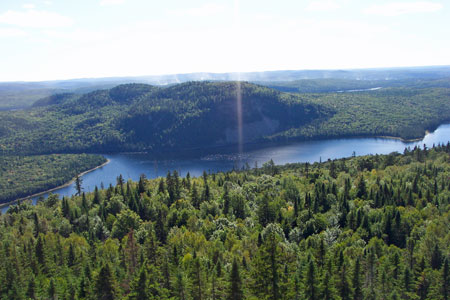
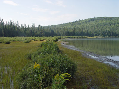
The large ponds include Deboullie, Gardner, and Black Ponds; smaller ponds (Mud Pond, Pushineer, Little Black, etc.) are scattered throughout the reserve. The reserve encompasses the entire shorelines of 11 ponds, with surface waters totaling almost 900 acres. These ponds are well known as sport-fishing areas, as long as one is willing to make the effort to get to them. Blueback trout (a.k.a. the landlocked arctic charr), an unusual variety of trout, occur in several of the lakes. Some pondshores have gradual transitions to upland, such as the Mud Pond basin, with various wetland habitats (e.g. Acidic Sedge Fens and Northern White Cedar Swamps). Other pondshores, where slopes come steeply into the pond basin, have an abrupt transition from aquatic to upland habitats.
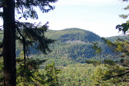
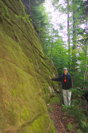
The mountains ringing the lakes include areas of spruce slope forests, northern hardwood forests, and exposed talus, reflecting the variety of exposures and slopes. The steep slopes of Deboullie and Black Mountains (and probably Whitman Mountain) support several stands of old-growth spruce (some over 200 years old); though uncut, all have been heavily damaged by budworm and subsequent windthrow. The ridges and upper slopes on Black Mountain and Whitman Mountain support mature Beech - Birch - Maple Forests, with trees over 50 cm dbh, fallen trees, and canopy gaps. The Cold-Air Talus Woodlands on Deboullie and Gardner Ponds (which are so sparsely treed that "woodland" is an exaggeration) are particularly noteworthy, with similar communities found in only a few other places in the state.
Away from the ponds and their hills are several broad stream valleys with extensive mature cedar forests along the drainages. The cedar forms a dense canopy over sedges, sphagnum, and boreal herbs.
Resources
- Deboullie Management Unit-Management Plan. 1987. Bureau of Public Lands, Department of Conservation, Augusta, Maine. 47 pp.
- Kern, M.J. 1985. Natural Resources Inventory and Critical Area Survey of T15 R9. Bureau of Public Lands, Department of Conservation, Augusta, Maine. 169 pp.