DACF Home → Bureaus & Programs → Maine Natural Areas Program → Maps, Data, and Technical Assistance
Maps, Data, and Technical Assistance
The Maine Natural Areas Program provides a variety of maps, data, technical assistance, and site review. If you don't see what you're looking for, please contact us.
Pre-acquisition Review
Project or Site Review
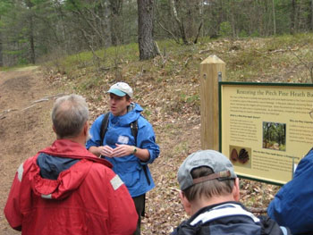
Natural Heritage Hikes
Information Requests
Forest Management Plan Review
Map Links and GIS Resources
- Beginning with Habitat Maps
- Boating Resource Links
- Coastal Resiliency Maps, including Tidal Marsh Migration
- Conservation Lands
- Ecological Reserves
- Land for Maine's Future Projects
- Maine Ecoregions
- Maine Geological Survey Maps, Publications, and Online Data
- Maine GeoLibrary (and Maine Geolibrary Data Catalog
- Map of Maine Land Trusts