DACF Home → Bureaus & Programs → Maine Geological Survey → Hazards → Earthquakes → Questions and Answers
Maine Earthquake Questions and Answers
- Q1. What is an earthquake?
- Q2. What causes earthquakes in Maine?
- Q3. What are the chances of having earthquakes in Maine?
- Q4. How can I tell if I live near an active fault line?
- Q5. You say that the chances are small, but still I find even the remote possibility of an earthquake to be unsettling. Isn't there anything I can do?
- Q6. Why do earthquake records change?
- Q7. I thought I felt an earthquake, but nobody else in town did. Am I crazy?
- Q8. Where are seismographs stationed in Maine?
- Q9. I never heard about earthquakes in Maine before, and now I've felt three in one year. What's happening?
- Q10. Don't you have instruments to record earthquakes? Why do you want me to fill out an Earthquake Questionnaire?
Q1. What is an earthquake? Back
An earthquake is a complex set of ground motions caused by sudden dislocation of rock along a break in the earth's crust. Such a break along which rock has moved is called a fault. In a single earthquake, the area of rock that moves is generally small, and the amount of fault dislocation may be only on the order of inches, yet a large amount of energy can be released due to the great pressures involved at depth. The energy released at the fault produces a variety of seismic waves that travel out in all directions through the surrounding rock. Some of the seismic waves travel up to the ground surface and travel outward across the countryside.
By analyzing the seismic records from each earthquake, seismologists can estimate the depth at which the fault break occurred. The depth at which an earthquake originates is listed as part of the permanent earthquake record. For Maine, earthquakes originate in the outer layer of the earth called the crust, at depths of a few miles to several miles. Another indication of earthquake depth is that no field studies in Maine have found evidence that any faults have broken the ground surface during the past several thousand years, although geologists have been looking. In other words, the faults responsible for modern earthquakes occur underground and do not extend up to the ground surface. It is true that over the past three centuries there have been a few earthquakes in New England large enough to cause damage to certain types of structures, such as brick chimneys or plaster walls or windows. These sorts of surface effects, which may be the result of a strong earthquake, should not be confused with underground faults that generate earthquakes.
Q2. What causes earthquakes in Maine? Back
The honest answer is that we don't fully understand the source of the underground forces that cause earthquakes in eastern North America. There must be some amount of regional stress distributed through the North American crust that causes rock somewhere to give way occasionally. Geologists and geophysicists have some hypotheses about the origin of the regional stress field, but no consensus has emerged. A nice article, "Why Does the Earth Quake in New England?", written by Prof. Alan Kafka of Weston Observatory, discusses this topic.
At least one thing, however, is clear. Geologically, the circumstances of earthquakes in eastern North America are much different from the circumstances in California or Alaska. A look at the plate tectonic map of the world shows that the west coast of North America is along a geologically active boundary between plates, whereas New England is in the middle of a large plate. The implications for earthquakes can be seen by comparing the plate tectonic map with the map of worldwide earthquakes. About 90% of all earthquakes occur near plate boundaries rather than within plates. Virtually all of the world's deep earthquakes occur near plate boundaries, whereas earthquakes within plates are generally shallow. Furthermore, the vast majority of the world's large earthquakes occur near plate boundaries.
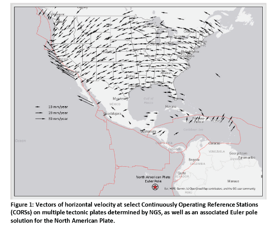
Therefore, we can say that the types of stresses that generate frequent, deep, and large earthquakes near plate boundaries are not affecting New England. The stresses here, though significant, seem to be smaller, and more broadly distributed through the crust. Precise measurement of earth surface movements by the National Geodetic Survey (NGS) shows that the earth's crust in the eastern U.S. is all moving the same way, whereas different parts of crust in southern California are moving in different directions.
Q3. What are the chances of having an earthquake in Maine? Back
Small earthquakes are common in Maine. In a typical year, Maine has several small earthquakes, most of which are too small to feel but a few of which may be felt locally. On the other hand, larger earthquakes have been few and far between and have a very small chance of occurring in any given year.
Predicting individual earthquakes in eastern North America is not possible. That is, there is currently no reliable way to anticipate where, when, or how large the next earthquake in a certain region will occur. Nonetheless, if enough earthquakes are recorded over a long period of time, seismologists have found that there are statistical patterns that allow probabilities to be calculated. Another way to think of it is that we expect the pattern of earthquakes in the future to be much like the pattern we have had in the past.
While different calculations may give slightly different estimates, the mathematical equations relating the number of earthquakes to earthquake size are logarithmic equations. This means that the larger an earthquake is, the less likely it is to occur. Small earthquakes ("very minor" to "minor") are expected to occur much more often than larger ones ("light"), and the probability of a "moderate" or "strong" earthquake occurring in New England is small. The statistics cannot guarantee what will happen, but they do indicate what to expect based on the geologic information available.
One measure of expected earthquake activity is shown by a series of seismic hazard maps, produced by the U.S. Geological Survey. These maps show the most intense earthquake motion that is likely to occur in a 50 year period at any place in the United States. For example, one of these maps shows that there is a 90% probability that the strongest earthquake in New England over the next 50 years will not cause significant damage (less than 8% g). Another map shows that the largest earthquake expected in Maine during the next 50 years will cause ground motion equivalent to Mercalli Intensity VI (at the 90% confidence level). For comparison, this ground motion is less than that produced near the center of the 1904 Eastport earthquake, Maine's largest historical earthquake at Mercalli Intensity VII, which did damage some chimneys near the epicenter but did not cause any reported structural damage or injuries. Yet another map, calculating the least likely occurrence -- a worst-case scenario -- shows that there is a 2% statistical probability that sometime during a typical 50-year period, central Maine may have an earthquake reaching Mercalli Intensity VII, and southwestern areas and Down East areas may have an earthquake reaching Mercalli Intensity VIII. By the same token, this means that there is a 98% probability that the largest earthquake to affect Maine during a 50 year period will be less than these values. Since Mercalli Intensity VIII is the lowest level at which significant earthquake damage is expected, it is fair to say that the probability of a damaging earthquake in Maine is small.
A different way to think about earthquake probabilities in Maine is by considering the estimated return time of various sized earthquakes. An estimated return time, or recurrence interval, is the length of time between earthquakes of a particular size in an area. It is the concept of return times that leads to the popular notion that a certain place may be "due" for a large earthquake at a particular time. Strictly speaking, it is not correct to think of return times as predicting earthquakes. Instead, they indicate expected long-term averages. Prof. John Ebel of Weston Observatory has calculated the following return times for Maine, based on recent earthquake measurements (reference).
| Magnitude | 4.6 | 5.0 | 5.5 | 6.0 | 6.5 | 7.0 |
| Return time (in years) | 20 ±2 | 46 ±5 | 127 ±13 | 355 ±42 | 989 ±119 | 2754 ±350 |
One way to look at these results is that for every century, Maine can expect five earthquakes of magnitude 4.6 or larger, two earthquakes of magnitude 5.0 or larger, and one earthquake of magnitude 5.5 or larger. And during each millennium Maine can expect three earthquakes of magnitude 6 or larger, and one magnitude 6.5 earthquake. The statistics predict that if Maine was ever to have a magnitude 7 earthquake it would be several millennia before another one would be expected. It is fair to point out that the calculations for earthquakes larger than 6.0 are mathematical projections. No earthquake that size has been reported from Maine since records began in the 1500's.
Q4. Do I live on an active fault line? Back
If you live in Maine, then the answer is no.
Most people who ask us about fault lines are really concerned about earthquakes instead. In some parts of the world, there is a close relationship between specific faults and earthquakes. In eastern North America, however, this is not the case. It is true that there are hundreds of old faults in the rocks of New England, but seismologists have not found any correlation between the frequency of modern earthquakes and the locations of old faults. This is different from California, for example, where earthquakes occur repeatedly along certain faults that are called "active." This means that there are no particular "fault lines" in Maine that are related to the modern earthquakes we have. The map showing all earthquakes recorded in Maine shows a widely scattered pattern. There are no "lines" of higher activity. The U.S. Geological Survey maps of seismic hazard show that mapped faults act as earthquake sources in the western U.S., but not in the central or eastern U.S.
This doesn't mean that we don't have earthquakes in New England. In fact, we do. But they are not related to any known "fault lines" visible at the ground surface.
Q5. You say that the chance of a moderate earthquake is slim, but still I find the possibility to be unsettling. Isn't there anything I can do? Back
As the media reported at the turn of the millennium, people have different ways of dealing with unpredictable, small risks. This question gets beyond geologic issues and into preparedness issues. Is it worth preparing for an event that will probably not happen in the next hundred years? If your personal answer is yes, there are several sources of common sense information about earthquake preparedness, both from the standpoint of personal safety and property. The Maine Geological Survey is not a primary source of information about civil preparedness issues. Click for some links to public agencies that can guide you. Keep in mind that most information about earthquake preparedness has been developed for places where the earthquake hazard is much higher than it is for Maine, so some suggestions that are reasonable elsewhere may not be appropriate here. Also be aware that standard homeowner's insurance does not cover earthquake damage.
Q6. Why do earthquake records change? Back
Since 1975, New England earthquakes have been recorded by seismic instruments of the New England Seismic Network. This network consists of seismometer stations installed at various places around New England, and linked by computer over satellite or internet connections. When an earthquake occurs, seismologists generally make a preliminary determination of its location and magnitude based on rapid analysis of selected information. This information is distributed to emergency management agencies and the news media as an "initial" report to verify that an earthquake has occurred. Due to many factors, including the distance between seismic stations and regional variations in seismic velocities, different stations may give slightly different values for the size and location of an earthquake. It may take several days before all the information from all the seismic stations (including information from the Canadian Seismic Network) is analyzed. The final "solution" which best fits all the data is normally a little different from the initial, preliminary calculation. For example, the December 24, 1999 Maine earthquake was initially reported to have a magnitude of 2.9, whereas the final calculation was 3.0.
For earthquakes before 1975, scholarly research into the original news reports of the day sometimes shows that inconsistencies or even typographical errors have occurred through the years. In these cases, it may turn out that an earthquake has been omitted from the record, or that an earthquake has been listed in the record incorrectly. In such cases, the "official" list of New England earthquakes may be revised.
Q7. I thought I felt an earthquake, but nobody else did. Am I crazy? Back
If you think you felt an earthquake but can't find anybody else who did, there are several possible explanations (other than your imagination). It is possible that very small earthquakes would not be recorded by the seismic network. In order to escape detection, however, an earthquake would have to be so small that it normally would not be noticed. But local geology (sand vs. rock), background noise, and building structure can all influence whether people notice very small earthquake movements. If conditions are right, it is quite common for one person to notice earthquake vibrations that are not noticed by a neighbor.
Another possibility is that there may have been a near-surface event, natural or otherwise, that caused just a localized ground shaking. Although not very common, cryoseisms can cause noises and shaking like an earthquake, but in a very localized area.
Q8. Where are seismographs currently stationed in Maine? Back
As of May 2022, there are five active stations in Maine, one in southern Maine at Colby College in Waterville, one in northern Maine at the University of Maine at Presque Isle, one in eastern Maine at the University of Maine at Machias, one in central Maine at Peaks-Kenny State Park in Dover Foxcroft and one in south-central Maine at the University of Maine at Orono. They each have an internet connection that allows direct access of the digital data record from Weston Observatory of Boston College, and from the National Earthquake Information Center in Colorado. The Weston web site has a map showing the locations of their seismic stations in New England, including their four in Maine. The seismic station at Peaks Kenny State Park was installed by the U.S. Geological Survey in July, 2006, as a "backbone" station of the Advanced National Seismic System.
Certain types of industries, such as blasting companies, may deploy portable seismographs around work sites. These are generally intended to measure surface motion and are not part of the earthquake monitoring network.
Since the inception of the modern New England Seismic Network by Weston Observatory in 1975, the number of stations in Maine has varied, reaching a peak of 18 active stations in 1980, decreasing to 11 in 1989, and down to one (Milo) in 1993, when the major federal funding was discontinued. The U.S. National Seismic Network maintained a seismic station at Caribou until 1994, after which the nearest USNSN station was at Lisbon, New Hampshire, near the Vermont border.
Q9. I never thought about earthquakes in Maine before, and now we've had three in one year. What's happening? Back
There is a long record of earthquakes in New England, going back to the 1600's. Small earthquakes, like the few we had in December 1999 and January 2000, are quite common. We have a good record of small earthquakes since 1975, which shows that Maine has had an average of one magnitude 3 earthquake per year. They do not occur at a constant rate, however. In some years we don't have any, and in other years we have had up to five. They are sporadic. For Maine to have four magnitude 3 earthquakes within a year (from February 1999 to January 2000) is well within the expected pattern of Maine earthquakes and does not indicate anything unusual. The Waterville-Skowhegan area just happens to be close enough to the February, 1999, earthquake and the two January, 2000, earthquakes that some people felt all three! In fact, those three earthquakes were about 50 miles apart. From the long-term record, there is nothing particular about being in the Waterville-Skowhegan area that makes it any more prone to earthquakes than being in any other place in central Maine. The pattern is random.
Another factor is that with improved scientific instrumentation and news communication, Mainers are more likely to hear about earthquakes in Maine that they didn't feel themselves. In the past, earthquakes did not make it into all the newspapers because the seismologic reports may not have been available for several days, by which time it was not "news" except to local papers. Now, with on-line technology connecting seismologists with their seismic instruments, and with data posted on internet sites for easy media access within hours, many earthquakes make statewide news that wouldn't have been so widely reported in the past.
Before the February, 1999, earthquake, it had been four years since the previous magnitude 3 earthquake in Maine. In 2001, Maine had only one. By the way, having three felt earthquakes in five weeks is not really very many. By comparison, California has several magnitude 3 earthquakes EVERY week. One difference is that they are more used to it than we are, so it doesn't make headlines.
Q10. Don't you have instruments to measure earthquakes? Why do you want me to fill out an Earthquake Questionnaire? Back
Yes, there are monitoring instruments that locate and measure each earthquake. But the instruments only record part of the story. There are two different kinds of earthquake size measurements, called magnitude and intensity. The magnitude measures the amount of energy released at the center of an earthquake. Each earthquake has a unique magnitude value, expressed in Arabic numerals, the number that is normally reported in the news. Magnitudes can be calculated from measurements recorded by the seismographs that are set up across a region. Various magnitude scales are used, depending on the size of the earthquake and the local geology (Richter magnitude, Moment magnitude).
The other measure of earthquake size, the intensity, describes the effect of earthquake motion at a particular place. When it comes to the effects of earthquakes on people, it is the intensity that is important. The best way to know the different intensities across the State caused by an earthquake is to ask people to describe what actually happened. This information will eventually allow seismologists and geologists to better understand the relationship between magnitude and intensity, and also to see how intensity varies in different parts of the state. For California, where earthquakes are frequent, these relationships are fairly well established. For New England, however, the relationships seem to be somewhat different. In particular, a magnitude 3 earthquake in Maine causes slightly higher intensities and over a much larger area than an earthquake of the same magnitude in California. So in order to understand Maine earthquakes we need to collect information from Maine. The earthquake questionnaire allows us to collect information on intensity, to complement the instrumental data on magnitude.
Last updated on June 30, 2022