DACF Home → Bureaus & Programs → Maine Geological Survey → Hazards → Earthquakes → Recent Maine Earthquakes → 12-12-12 Earthquake
December 12, 2012, Earthquake in Canada, near La Malbaie, Quebec
Earthquakes Canada, the New England Seismic Network, and the U.S. Geological Survey report that an earthquake occurrred at 12:46 pm (EST), Wednesday afternoon, December 12, 2012, near the St. Lawrence River, northeast of Quebec City.
The following parameters have been calculated for the earthquake:
| Magnitude | 4.4 (Nuttli magnitude) or 3.9 (body-wave magnitude) |
| Location | 47.78 degrees North latitude, 70.05 degrees West longitude |
| This places the epicenter northeast of La Malbaie, Quebec, about 140 miles northwest of Fort Kent, Maine. | |
Felt Reports
The earthquake was felt widely along both sides of the St. Lawrence River from Quebec City to the northeast, and weakly in northernmost Maine. This event occurred in the Charlevoix Seismic Zone, the most active seismic zone in the northeast.
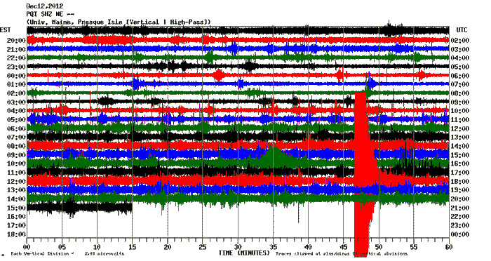
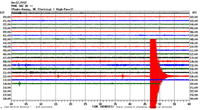
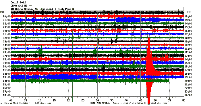
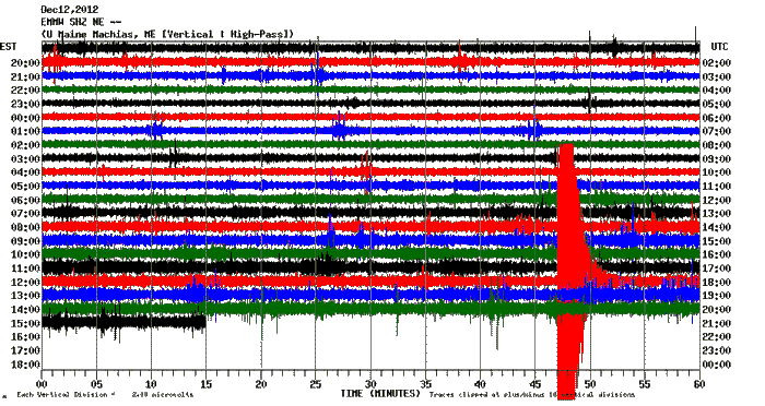
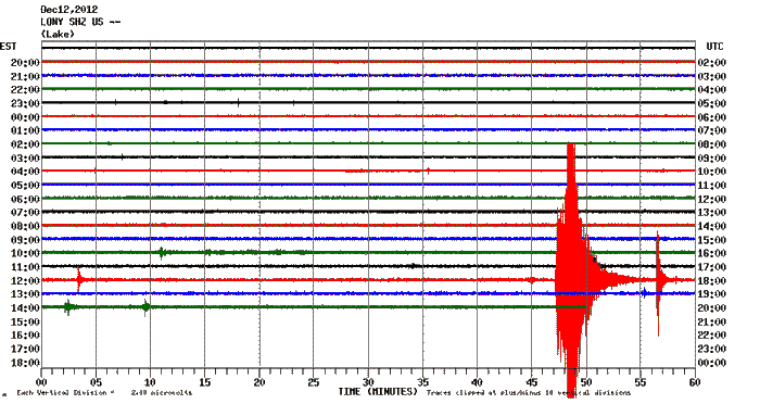
Seismic Recordings
Automatic data recorders across the region recorded the earthquake. Here are some of the plots from the region, in order from closest to the epicenter to farthest.
- Presque Isle, Maine (station PQI)
- Dover-Foxcroft, Maine (station PKME)
- Orono, Maine (station ORNO)
- Machias, Maine (station EMMW)
- Lake Ozonia, New York (station LONY)
Last updated on December 14, 2012