DACF Home → Bureaus & Programs → Maine Geological Survey → Explore Maine Geology → Coastal Marine Geology → Frequently Asked Questions → Sea-level Curve
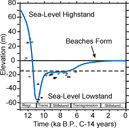
Maine has one of the best-studied Holocene sea-level curves in the world; we use salt marsh peats as markers of sea level. Radiocarbon dating supplies the time information to construct a sea-level curve from these preserved peats.
Last updated on October 6, 2005