Unacceptable map
The map below is an example of a map that is unacceptable for the Commission’s purposes, as it is unclear as to which road the project is on due to the poor print quality, the project boundaries are not shown, and buildings are not indicated on it.
In cases where such maps are submitted without additional, better quality maps, the Commission will invariably respond with a letter requesting that a better map (7.5’ USGS topographic quad map), with the project boundaries shown, be submitted for review.
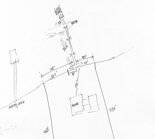
Good example of a site plan for a dock/pier system
This site plan is an effective supplement to a 7.5' quad map. The project location is clearly located. Due to the project’s relatively small size (it is a proposed dock system), it is not necessary, in this case, to show project boundaries.
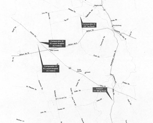
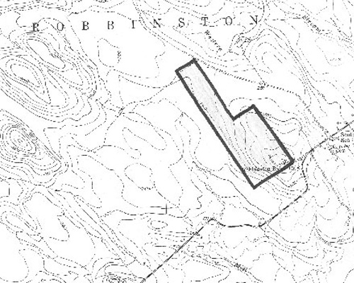
Good example of a location map for a subdivision, or other large scale development
This map is a good example of a 7.5’ USGS quad map with the project location and boundaries clearly identified.
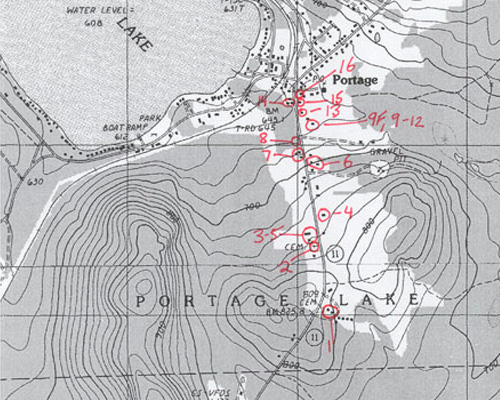
Good example of a 7.5’ USGS quad map with numbered photos of buildings keyed to it
This is a good example of a 7.5’ USGS topographic map with building/photo locations clearly keyed to it. The numbers correspond to numbers on photos and/or the MHPC Historic Building/Structure Survey Form.
Example of poor quality photos of buildings
These photos can not be used to accurately evaluate the subject buildings because the buildings are largely obscured by trees in the foreground, and the bottom photo is of very poor quality. Better angles should have been chosen by the photographers to get better views of the properties.
The Commission would likely respond to all of these with a letter requesting better photos of the buildings, thus extending the consultation process. For more detailed information regarding appropriate survey materials, please see our architectural survey guidelines.
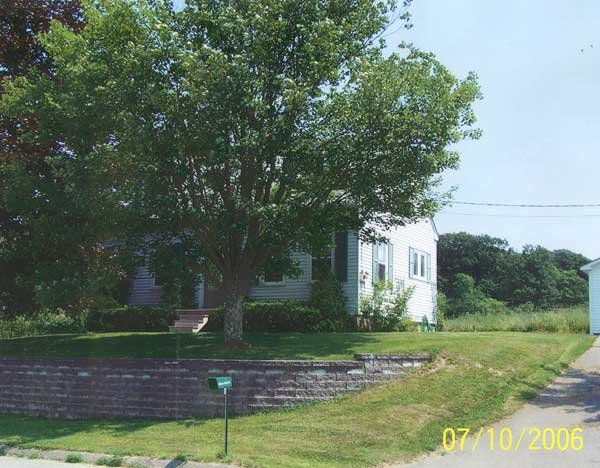
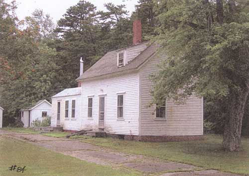
Good example of photos of buildings
The following are good examples of building photos. They are clear, shot at an oblique angle, and show relatively unobstructed views of the buildings' primary facades.
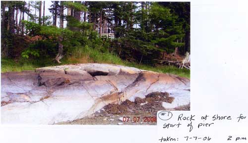
Good example of shoreline photos for dock systems
This is a good quality photo of the shoreline submitted by an applicant for a dock system review. The photo clearly shows the shoreline exactly where the proposed project will impact it.
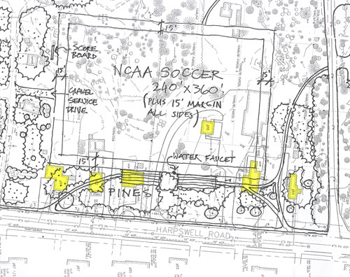
Good example of project plans overlain on a tax map
The image below shows project plans drawn over a tax map with surveyed properties highlighted. In this case the surveyed buildings were identified and keyed to photos by property addresses, which are printed within the building “footprints”.