DACF Home → Bureaus & Programs → Maine Natural Areas Program → Ecological Reserves → Chamberlain Lake
(Printer Friendly Version-55 KB pdf) (Download a free copy of Adobe Acrobat Reader)
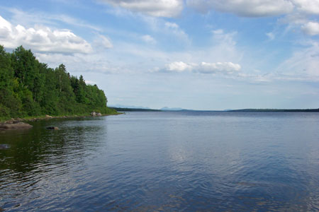
Chamberlain Lake
Eagle Lake Twp., Soper Mountain Twp., T7 R12 WELS, T7 R13 WELS
Vital Statistics
- Size: 2,890 acres
- Regulated: 2,825 acres
- Non-Regulated: 65 acres
- Upland: 2,723 acres
- Forested Wetland (NWI): 151 acres
- Non-Forested Wetland: 21 acres
- Open Water: 0 acres
- Roads: 0 miles
- Biophysical Region: St. John Uplands
- BPL Region: North
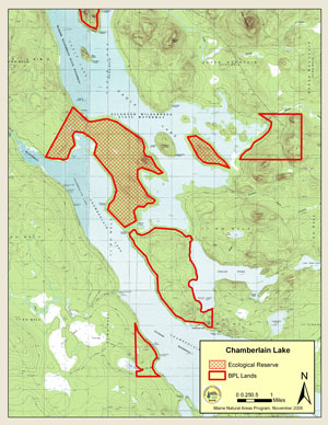
(Download a Printer Friendly Version-500 KB pdf-of this map.)
Exemplary Natural Communities
Rare Plants
There are no documented occurrences of rare plants within this Ecoreserve.
Rare Animals
There are no documented occurrences of rare animals within this Ecoreserve. For more information on rare animals in Maine, visit the Maine Department of Inland Fisheries and Wildlife.
Description
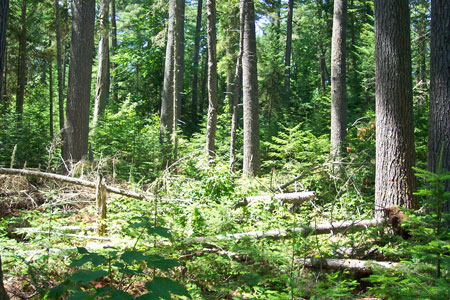
Near the head of the Allagash Wilderness Waterway, the Chamberlain Lake ecological reserve lies on the Bear Mountain peninsula in Chamberlain Lake. Nearly all of the reserve was classified as regulated timberland, and less than 5% is wetland (mostly coniferous wetland). Many locations sampled during the Ecological Reserves Inventory and later monitoring efforts indicate past selective harvesting, but harvesting has apparently not occurred within the last 50+ years, based on ages of stumps and old logging roads. Several areas of matrix-forming natural communities are in outstanding condition. The most noteworthy stands are mixed hardwood-conifer stands supporting trees over 200 years old. Interestingly, charcoal pellets were found in all stands sampled, although the dominance of mid to late-successional stand types suggests that fires in most locations occurred long ago. Other intact forest types include a large black spruce bog and swamp just north of Lock Dam and a small, stunted spruce slope forest on top of Bear Mountain.
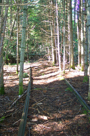
The northern part of the Reserve includes the Eagle Lake Tramway, remnants of an old logging railway that transferred logs from Chamberlain to Eagle Lake over a century ago.
Resources
- Rooney, S.C. 1981. A preliminary natural resources inventory, Telos Public Lot, T6 R11 WELS. Bureau of Public Lands, Department of Conservation, Augusta, Maine. 33 pp.
- Telos Unit Management Plan. 1990. Bureau of Public Lands, Department of Conservation, Augusta, Maine. 39 pp.
- Weber, J.E. and S.C. Rooney. 1993. An ecological inventory of the Chamberlain Lakes Unit. Bureau of Public Lands, Augusta, Maine. 8 pp. (+ appendices).