DACF Home → Bureaus & Programs → Maine Natural Areas Program → Maps, Data, and Technical Assistance → Coastal Resiliency
Coastal Resiliency
"Coastal resilience means building the ability of a community to "bounce back" after hazardous events such as hurricanes, coastal storms, flooding, -rather than simply reacting to impacts." -National Ocean Service, NOAA
Maine's saltmarshes are an important transitional habitat between the ocean and the land. They provide vital habitat for a variety of animals and plants, support recreational opportunities, and perform many valuable functions including mitigating storm surge and filtering pollutants.
This page provides a roadmap to currently available data related to tidal marshes, tidal marsh migration, and undeveloped blocks under various sea level rise scenarios. The table below provides details on the different tidal marsh migration data sets that are avalable through this site. Click on a link to go to that page to view the map or download the data set.
| Data Set | Data Description | Primary Data Use |
| Potential Tidal Marsh Migration | Current Tidal Marshes and future marsh migration within tidal estuaries on undeveloped lands under 0, 1.2, 1.6, 3.9. 6.1, 8.8, and 10.9 foot sea level rise simulations | To view the inland extent of several sea level rise scenarios only on undeveloped land within tidal estuaries, i.e., locations along the coast where potential remains for marsh migration on to currently undeveloped land. These data are intended to help inform conservation or land management planning to support future tidal marsh migration on multiple scales. |
| Sea Level Rise/Storm Surge | Inland extent of several scenarios (0, 1.2, 1.6, 3.9. 6.1, 8.8, and 10.9 foot) sea level rise simulations; includes developed and undeveloped areas | To view the inland extent of several sea level rise scenarios. This "bathtub" model can help inform storm surge and sea level rise vulnerability assessments. |
| Report | Funding Source | Report Summary |
| Marsh Migration in Maine 2023; The Next Wave : Using the Best Science to Build Tools for Coastal Marsh Conservation; A Final Report to the Maine Outdoor Heritage Fund | Final Report to the Maine Outdoor Heritage Fund Project #: 201-01-09 | This study reports on a new geospatial data set used for applying sea level rise and marsh migration simulations for six SLR scenarios from 1.2 to 10.9 feet. |
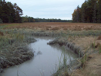
Maine's saltmarshes are amongst the most productive ecosystem on earth (in terms of biomass production). Their numerous functions and values include:
- habitat for birds, finfish, shellfish, crustaceans, mussels, and insects, including commercially valuable or rare, threatened, or endangered species
- erosion control and mitigation against waves, storm events, and sea level rise
- mosquito control (healthy marshes provide habitat for fish that eat mosquitoes)
- water quality maintenance (saltmarshes filter pollutants)
- Maine's coastal wetlands are used by 2/3 of our commercially valuable fish, shellfish, baitworms, and other organisms at some point in their life cycle
- tidal saltmarshes act as Carbon sinks and help regulate the release of carbon into the atmosphere; Maine's salt marshes store approximately 73,000 tons of CO2 each year
- saltmarshes provide an open, greenspace that can increase property values in neighboring communities and enrich our visual landscape
- saltmarshes provide exceptional recreational opportunities for hunting, fishing, boating, and bird-watching
This work was supported by funding from the Maine Outdoor Heritage Fund and the U.S. Environmental Protection Agency.