DACF Home → Bureaus & Programs → Maine Geological Survey → Explore Maine Geology → Coastal Marine Geology → Saco Bay Beach Morphology → Discussion → Figure 27 → Figure 27B
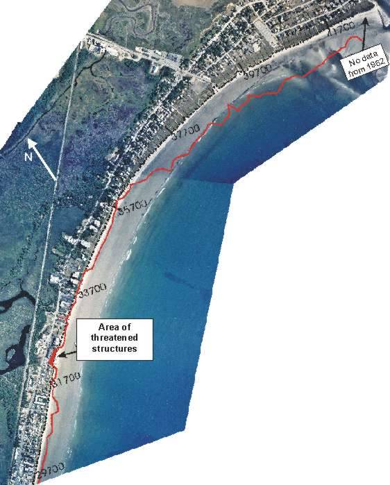
Figure 27B. 1995 aerial photograph showing projected 100-year shoreline position along central to northern parts of region 3. Projected erosion occurs at the location of the former Little River Inlet, while a dramatic accretive trend is projected for the northern shoreline, from roughly 35,700 ft northwards to the Scarborough River jetty (not to scale).
Last updated on January 10, 2006.