DACF Home → Bureaus & Programs → Maine Geological Survey → Explore Maine Geology → Coastal Marine Geology → Saco Bay Beach Morphology → Discussion → Figure 27
 |
 |
|
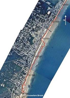
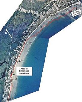
| Figure 27A. 1995 aerial photograph showing projected 100-year shoreline position along southern part of region 3. Accretive trend from 19,700-25,500 ft may be attributed to artificial dune construction, and may not occur naturally. From 25,500 ft northwards, there is little change expected (possibly minor accretion) due to shoreline stabilization with seawalls (not to scale). For larger view, click on image. | Figure 27B. 1995 aerial photograph showing projected 100-year shoreline position along central to northern parts of region 3. Projected erosion occurs at the location of the former Little River Inlet, while a dramatic accretive trend is projected for the northern shoreline, from roughly 35,700 ft northwards to the Scarborough River jetty (not to scale). For larger view, click on image. |
Last updated on January 9, 2006.