DACF Home → Bureaus & Programs → Maine Geological Survey → Explore Maine Geology → Coastal Marine Geology → Saco Bay Beach Morphology → Results → Figure 14
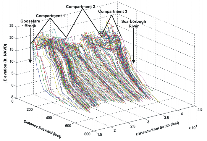
Figure 14A. Beach profiles along region 3 (Goosefare Brook to Scarborough River jetty).
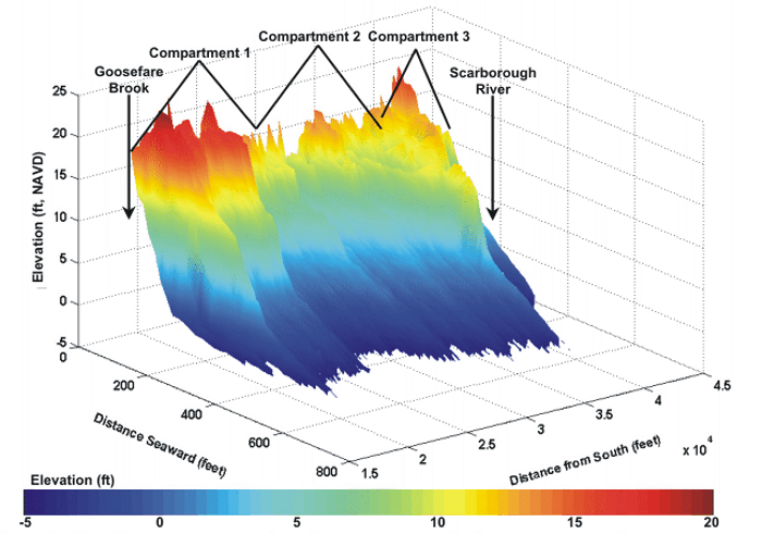
Figure 14B. Color-interpolated plot of beach profiles in region 3. Note high elevations of profiles in the southern part of region 3, while profiles in the central portion are low and relatively flat. High elevations may be attributed to the construction of an artificial dune, while seawalls stabilize the central section.
Last updated on January 9, 2006.