DACF Home → Bureaus & Programs → Maine Floodplain Management Program
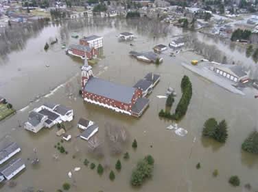
Flood event in Fort Kent on May 1, 2008
National Flood Insurance Program - NFIP
The National Flood Insurance Act of 1968 and the National Flood Insurance Program provide flood insurance protection to property owners in flood-prone areas. The NFIP provides maps, regulations and insurance. The community is responsible for administering and enforcing the regulations.
Maps ~ Insurance ~ Community
About Us
The Maine Floodplain Management Program works with individuals, communities and professionals to reduce the risk of flooding.
5,779 lakes and ponds ~ 5,299 miles of coastline ~ Over 8,600 miles of floodplains
Flooding in Maine is largely the result of coastal storms, heavy spring rains, runoff, and ice jams. This flooding has been responsible for millions of dollars of property damage. There are approximately 33,000 structures at risk of flooding in Maine. Your community can assist citizens in protecting their property from losses due to flooding by joining the National Flood Insurance Program (NFIP). It is estimated that up to 75% of homes and businesses in floodplains in Maine are NOT covered by flood insurance. The average annual flood insurance policy premium in Maine is $944. There is a 30-day waiting period before the flood insurance policy goes into effect.
The NFIP is the only source of affordable flood insurance and offers property owners an opportunity to purchase flood insurance. This insurance is available only in participating communities that have made a commitment to practice sound land use management. Currently, there are over 5,000 flood insurance policies in effect in Maine with coverage totaling over $1.4 billion. Mortgage loans and disaster assistance are severely limited in communities that do not participate in the NFIP.
Maine Floodplain Management Program staff provides technical information, floodplain maps and model ordinances to communities interested in joining the NFIP, as well as to participating communities.
Program staff also provides information and assistance to homeowners, businesses, lenders, realtors and others with questions regarding floodplain maps, insurance issues and the National Flood Insurance Program (NFIP).
National Flood Insurance Program (NFIP)
The program helps communities participating in or interested in joining the NFIP by providing technical information, floodplain maps, and model ordinances. The program offers workshops on how to read and use flood maps, interpret ordinances, and administer floodplain management requirements. Program staff also reviews local ordinances for compliance with the NFIP standards. Staff also provides information about flooding or the NFIP to: homeowners, businesses, lenders, realtors, surveyors, engineers, and others.
Map Modernization - Risk MAP
The accuracy of flood maps is important for determining appropriate flood insurance rates and local and state permits, and because lending institutions rely on them when deciding to grant loans (or not to grant loans) for structures located in the floodplain. The Maine Map Modernization Program is a federally-funded initiative to update, remap, and digitize the country's flood hazard areas. The goal for the program is to use local knowledge to create a more accurate digital product that will improve floodplain management across the country. The updating will occur first in those communities meeting flood risk thresholds based upon population and numbers of structures at risk. Additional communities will be remapped as federal funding becomes available.
Community Assistance Program
The Community Assistance Program (CAP) is a product-oriented, financial assistance program for states that is directly related to the flood loss reduction objectives of the National Flood Insurance Program (NFIP). The CAP is intended to identify, prevent, and resolve floodplain management issues in participating communities before they develop into problems requiring enforcement action. A large component of CAP involves technical assistance, outreach, and training.
Community Rating System
The more a community does toward good floodplain management, the more points they can get toward reducing the flood insurance premiums for its citizens. For each 500 points earned, the community qualifies for a 5% reduction in the premiums paid by its citizens who purchase flood insurance. There are 18 activities that communities can do to reduce the flood risk in their town. Program staff can assist communities with qualifying for premium reductions through the Community Rating System (CRS). These services are also available from the Federal Emergency Management Agency (FEMA) Regional Office in Boston, as well as from the regional councils across the state.
Flood Hazard Mitigation/Mitigation Assistance Program
Flood hazard mitigation lessens the impact disasters have on people's lives and property. Mitigation is accomplished through measures such as engineering and building structures to withstand flooding, creating and enforcing effective building codes to protect property from floods, hurricanes and other natural hazards, and removing homes from within the floodplain altogether. Mitigation is the cornerstone of emergency management. The Federal Emergency Management Agency provides financial assistance to states to develop and maintain a comprehensive, statewide hazard mitigation capability for the purpose of implementing pre- and post-disaster mitigation.
Permit Reviews
The program works with other state agencies to ensure that development under state review is designed and developed to reduce future flood damages. For example, the program works with the Department of Economic & Community Development by reviewing Community Development Block Grant (CDBG) projects, the Department of Environmental Protection (DEP) and the Department of Agriculture, Conservation and Forestry in reviewing development under the provisions of the Natural Resources Protection Act (NRPA) and the site location law.
Sustainability/Sustainable Re-development
A new initiative and integral part of the mitigation function is the concept of sustainability. Sustainability is development or re-development that maintains or enhances economic opportunity and community well-being while respecting, protecting, and restoring the natural environment upon which people and economies depend. Sustainable re-development is simply the application of the concepts and practices of sustainable development to the disaster recovery process.