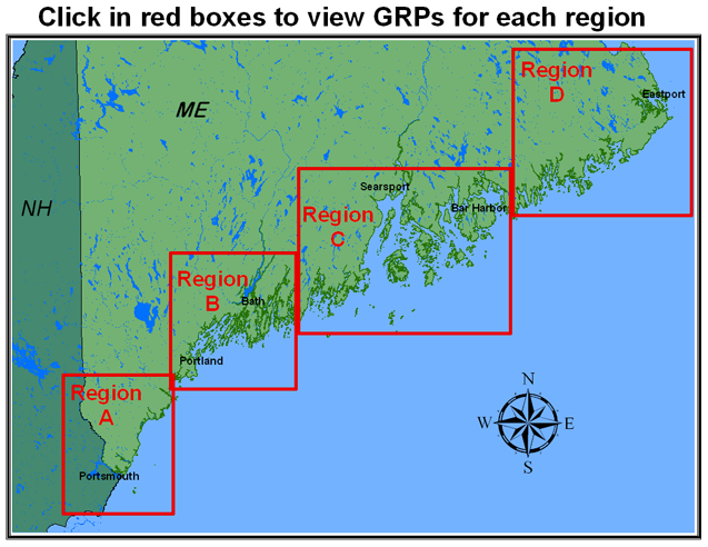
Geographic Response Strategies for Maine & New Hampshire
Each Geographic Response Strategy consists of a set of two pages. The first page shows an aerial photo and nautical chart of the area with the proposed booming strategy visually laid out. Page two contains a verbal description of the booming strategy, as well as the total length and type of boom required, the water depth range, site access, staging areas, collection points, and any social, historical, and environmental concerns. The pages for each GRS are contained within an Adobe Acrobat document.
When printing, check "fit to page" for desired page size.
Maine planned boom locations for Google Earth
New Hampshire planned boom locations for Google Earth
Casco Bay Geographic Response Strategies and Shorelines