Skip Maine state header navigation
Bedrock |
||
| Much of the Allagash region is underlain by 400-million-year-old Seboomook Slate, especially west and north of the big lakes. Some of the oldest rocks, perhaps as old as 500 million years, can be seen along the northeastern shore of Chamberlain Lake near the Arm of Chamberlain. Colorful volcanic rocks, more than 400 million years of age, appear along the west shore of Allagash Lake and in and around Smith Brook. Ancient igneous granitic rock, an unusual rock type in the region, makes up Priestly Mountain. |
Fossils |
||
| Evidence of warm ancient seas can be found in the fossil record of the Allagash. Fossils discovered in ledges on the shores of Chamberlain Lake reveal old reef fragments, traces of corals, such as fans and honeycombs, and remnants of spongelike animals called stromatoporoids. The rock containing the fossils is pocked with holes from thousands of years of weathering, and in some of the holes you can see the distinctive pattern of the honeycombs. Along the shores of Round Pond and Telos Lake are outcrops of Seboomook Slate with fossils of brachiopods and gastropods. The abundant brachiopods, also called lamp shells, are small marine invertebrates with two hinged shells or valves, similar in appearance to bivalved mollusks. The spiral-shelled gastropods, a class of mollusk, were present in the ancient seas as well. Fossils of brachiopods, crinoids (also called "sea lilies" because of their flowerlike forms), and corals have been found in the vicinity of Smith Brook. Reminder: Waterway rules prohibit the removal of anything; please leave fossils undisturbed for other visitors to see. |
Ice Cave |
||
You can find a cave near the west shore of Allagash Lake by following a trail from the Ice Cave Site on the shore of the inlet cove. From the top of a knoll, you can see the cave's major entrance. If you decide to crawl down into the cave, do so with caution. A small, steep, wet passage opens 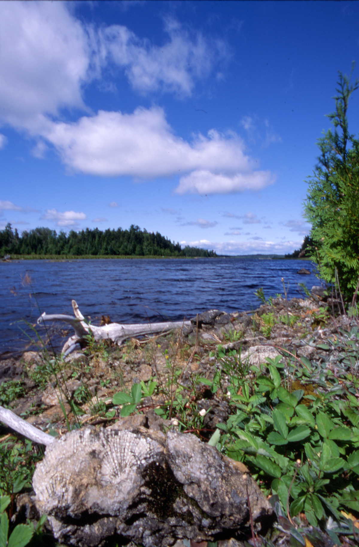 Outcrop of tabulate coral fossils into a large room about thirty feet down. Two tunnel-like crevices lead off from opposite sides of the room. Some explorers have reported finding ice in the cave during midsummer. |
Glacial Features |
||
| Sometime between 25,000 and 21,000 years ago, a sheet of ice over a mile thick scraped and gouged its way across the Allagash region. By 10,000 years ago the glacier had receded from the state. Today, you can see the effects of the glacier throughout the waterway. Scratches and grooves on outcrops, such as those on the flat ledge at the top of Little Allagash Falls, provide evidence of several major ice flows. At least two were in an east-southeast direction, but another flow was most unusual in that it took a northwesterly course. Evidence of the unusual flow is especially noticeable from Umsaskis Lake northward. The departing ice sheet left the lakes reoriented and the hills and mountains reshaped, often with long, gradual northwestern slopes and steep, ledgy southeastern sides. The ledges on the south side of the outlet of Allagash Lake are outstanding examples of glacial smoothing and shaping. The scratched and polished slate emerges ramplike and low-angled from the lake. Meltwater streams from the receding glacier left a variety of deposits. As you travel the waterway, notice stream-side banks of stratified and sorted sands and gravels along the shores and glacial till -- boulders, cobbles, gravels, and finer materials left scattered across the landscape -- back from the shore. |
![]()
![]()
![]()