DACF Home → Bureaus & Programs → Maine Natural Areas Program → Ecological Reserves → Tunk Lake Area (Spring River Lake and Donnell Pond)
(Printer Friendly Version-34 KB pdf) (Download a free copy of Adobe Acrobat Reader)
Tunk Lake Area (Spring River Lake and Donnell Pond)
T10 SD, T9 SD
Vital Statistics
- Size: 6,215 acres
- Regulated: 1,749 acres
- Non-Regulated: 4,201 acres
- Upland: 5,394 acres
- Forested Wetland (NWI): 173 acres
- Non-Forested Wetland: 509 acres
- Open Water: 162 acres
- Roads: secondary-0.5 mile
- Roads: trails-5 miles
- Roads: total-5.5 miles
- Biophysical Region: Eastern Coastal
- BPL Region: East
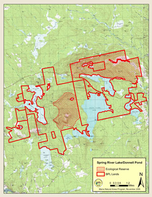
(Download a Printer Friendly Version-573 KB pdf-of this map.)
Exemplary Natural Communities
Rare Plants
| Scientific Name | Common Name | State Rank | Global Rank | State Status |
|---|---|---|---|---|
| Minuartia glabra | Smooth sandwort | S3 | G4 | SC |
Rare Animals
There are no documented occurrences of rare animals within this Ecoreserve. For more information on rare animals in Maine, visit the Maine Department of Inland Fisheries and Wildlife.
Description
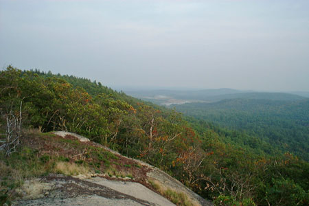
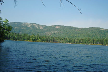
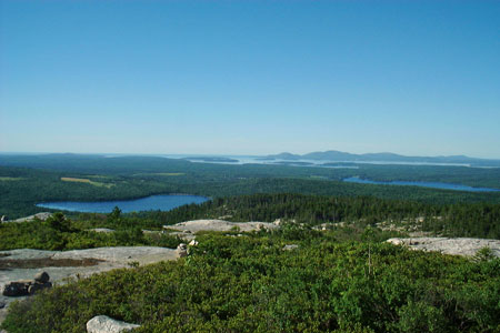
Two proximal reserves have been designated here: 1,940 acres east of Donnell Pond and 4,274 acres northeast of Spring River Lake. The mountains and lakes formed by the Tunk Mountain Pluton constitute one of the most distinctive landmarks of the East Coastal Region. The two reserves include mid-elevation (~1,000 foot) summits of Tunk Mountain, Black Mountain, and Caribou Mountain as well as Tilden Pond, Little Long Pond, and Wizard Pond.
The bedrock and surficial geology of the area create a variety of ecological zones that follow gradients of slope, aspect, and moisture and have been modified to varying extents by past land use and fire.
From upper to lower elevations, these mountains include heath-krummholz summits and low-elevation summit balds, intact spruce-fir-broom-moss forests on steep slopes, drier oak-pine forests on south facing slopes, post-burn early successional hardwood forests, and forests regenerating from past harvest. In general, forests at mid and higher elevations show greater evidence of past fire, whereas lower elevation stands have a less apparent fire history but more obvious evidence of recent harvesting. The effects of fire varied with fire intensity. In most areas medium intensity fires appeared to limit shrub and sapling development but did not kill the forest canopy. Other areas, such as the southeastern side of Caribou Mountain, apparently burned at a higher intensity, resulting in an early successional stand dominated by paper birch (Betula papyrifera), grey birch (Betula populifolia), and red maple (Acer rubrum).
Among the more noteworthy ecological features of this area is a small (~20 acre) stand of old growth red spruce (Picea rubens) around Wizard Pond in a saddle near the summit of Black Mountain. This stand, which has been inaccessible because of surrounding steep and rocky terrain, has no evidence of human disturbance and has numerous trees dating previous to 1750, including one to 1692.
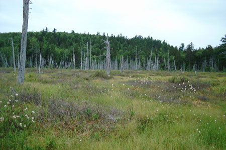
Lowlands and stream valleys have dozens of beaver flowages in varying stages of succession.
Resources
- Cutko, A. 2004. Natural Resource Inventory of the Donnell Pond and Spring River Lake Units: Revised and Updated. Maine Natural Areas Program, Augusta.
- Donnell Pond Unit Resource Management Plan. 1991. Bureau of Public Lands, Department of Conservation, Augusta, Maine. 46 pp.
- Rooney, S. and J. McMahon. 1991. 1991 Ecological Survey of the Donnell Pond Unit (Draft) Bureau of Public Lands, Augusta, Maine. 6 pp. (+ Field Survey Forms)
- Reports and papers based on research in the Tunk Mountain region. (Summary list of 44 publications), compiled by Steve Kahl, University of Maine.