Home → Bureaus & Programs → Bureau of Parks and Lands → Find Parks & Lands → Park Details
 Land for Maine's Future
 Maine Trail Finder
Description
Please check for access and COVID-19 updates by using this link.
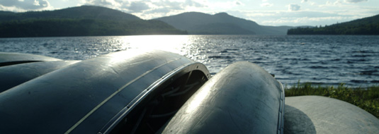
Enjoy backcountry recreation in a spectacular natural setting.
Great Circle Trail Announced
The Great Circle Trail completion was celebrated on Saturday, Sept. 25, 2021. View a short video about the Great Circle Trail. View the new Nahmakanta map with the Great Circle Trail highlighted.
Hikers, campers, hunters, fishermen, snowmobilers and paddlers all enjoy the rugged hills, abundant wildlife and clear waters of this remote region southwest of Baxter State Park. The Nahmakanta Public Lands encompass 43,000 acres of sprawling forests and low mountains (the largest stands at 2,524 feet). Numerous streams and brooks course down steep slopes and run through narrow gorges. Within Nahmakanta's boundary lie 24 "great ponds" (10 or more acres in size) and more than 50 miles of undeveloped shoreline.
An extensive network of hiking trails leads visitors along lakeshores, up to open ledges, and past popular attractions like Tumbledown Dick Falls and Pollywog Gorge, a mile-long gorge with sheer walls that rise 180 feet. The Nahmakanta portion of the Appalachian Trail (AT) lies within the upper reaches of the 100-Mile Wilderness, considered by many to be the AT's most remote section though not a designated "wilderness area".
During warm weather, ATV riders explore a network of shared-use roads. Fall months draw hunters in search of moose, bear, grouse and deer. In winter, snowmobiles traverse Nahmakanta Public Lands along designated trails such as ITS 85/86 (which links Millinocket and Greenville).
Within the Nahmakanta Public Lands is the State's largest Ecological Reserve, an 11,802-acre expanse that includes much of the property's 9,200-acre roadless area (known as the Debsconeag Backcountry). The State's Ecological Reserve designation ensures that sensitive plant communities will remain in their natural condition and be monitored over time.
The Nahmakanta Public Lands lie in the heart of a diverse complex of approximately 500,000 conserved acres that runs from Katahdin Iron Works in the south to Baxter State Park in the north.
Partners and Supporters
The Land for Maine's Future Program generously funded acquisition of more than two-thirds of the Nahmakanta Public Lands. The National Park Service owns 1,820 acres of the Appalachian Trail Corridor that crosses the property, including most of the frontage along Nahmakanta Lake. The Maine Appalachian Trail Club maintains this section of the AT. Forest management activities are Green certified by the Forest Stewardship Council & the Sustainable Forestry Initiative. Local logging contractors donate labor and equipment time to improve snowsled and ATV trails. Adopt-a-trail volunteers and supporters also help maintain the Nahmakanta lands: please contact the Bureau of Parks and Lands if you wish to help.
Land for Maine's Future This property was acquired in part with funds from the Land for Maine's Future program. For more information about the LMF program and the places it has helped to protect, please visit the LMF webpage.
Services and Facilities
The Bureau of Parks and Lands maintains 5 authorized campsites with privies on Wadleigh Pond, 2 near Musquash Brook, and 2 on Pollywog Pond. On lands owned by the National Park Service bordering Nahmakanta Lake, there are six authorized sites where campfires are permitted. Fire permits are needed for the primitive, traditional campsites on Sing Sing and Rabbit Ponds as well as the sites at Pollywog Pond, Leavitt Pond and Tumbledown Dick Pond.
Of the 22 campsites, 10 are drive-to, 9 are boat-to, and 3 are walk-to. There is a hand-carry boat launch at Fourth Debsconeag Lake (with 6 parking spots at most).
28 miles of hiking trails, in addition to 9 miles along a highly scenic stretch of the Appalachian Trail
Timber Management on Maine's Public Lands
The Maine Bureau of Parks and Lands (BPL) manages its public lands to achieve multiple benefits: public recreation, wildlife habitat and timber sales (revenues from which help fund land management). The Bureau adheres to strict practices in selectively harvesting timber, minimizing runoff and soil erosion, and taking other measures to ensure that the health of the larger ecosystem is maintained. BPL's forest practices are green-certified by two independent auditors - the Forest Stewardship Council and the Sustainable Forestry Initiative.
History
Underlying much of the Nahmakanta Public Lands is a massive body of ancient granite that extends up to Mt. Katahdin in Baxter State Park. The rock's resistance to weathering accounts for the region's rugged outcrops and bald summits. A thin layer of crushed rocks deposited by glaciers roughly 13,000 years ago covers much of the bedrock.
Most of the forests around Nahmakanta have been harvested several times, including just prior to the State's acquisition in 1990. In a few areas, though, old-growth trees remain. The Bureau of Parks and Lands manages portions of the Nahmakanta forests for the sustainable production of timber and the targeted wildlife benefits that derive from certain forest management practices. Revenues from timber sales help support the ongoing costs of managing Maine's Public Lands.
If you are interested in learning about geology around the state, check out the Maine Geological Survey Searchable Database.
Activities
- ATV riding
- Boating (motorized)
- Camping
- Canoeing
- Cross-country skiing
- Fishing
- Hiking (trails)
- Hunting
- Snowmobiling
- Snowshoeing
- Swimming
- Watchable wildlife
Rules
- Kindle fires only in authorized campsites with fire rings and cut no live vegetation.
- Carry out all trash.
- Do not discharge weapons within 300 feet of any picnic area, camping area, parking area, marked hiking trail or other developed area. Loaded firearms are not permitted at campsites or on hiking trails.
- Bureau of Parks and Lands staff may take custody of any personal property left unattended for more than 3 days (unless advance written permission is given).
Consider lending a hand. Contact us if you would like to help with stewardship or maintenance work.
Trails
Appalachian Trail (moderate at Nahmakanta) has more than 9 miles that crosses the Nahmakanta Public Lands. The 1.2-mile (one-way) hike south from the AT road crossing east of Pollywog Pond offers stunning views from ledges on Nesuntabunt Mountain.
Turtle Ridge Loop Trail (9.6 miles roundtrip from the west trailhead on the Penobscot Brook Road; 8.6 miles from east trailhead on Jo-Mary Road, moderate) crosses densely wooded terrain, passing several ponds and open ledges that periodically offer panoramic views of surrounding mountains.
Debsconeag Backcountry Trail (12-mile roundtrip, moderate) has east trailhead near inlet of Fourth Debsconeag Lake, and west trailhead north of Nahmakanta Lake near Rainbow Stream. The figure-eight trail layout provides several options to explore pristine ponds nestled throughout the State Ecological Reserve.
Tumbledown Dick Trail (4.6 miles one-way, moderate) links the AT with Leavitt Pond and the Turtle Ridge trail system, providing access to scenic falls and to campsites at Tumbledown Dick and Leavitt Ponds.
MOTORIZED TRAILS
ITS 85/86, a major snowmobile trail linking Greenville and Millinocket (both snowmobiling hubs), provides trail touring and access for ice fishing on Nahmakanta Lake. Unplowed roads are open to snowmobiling as well (plowing changes year to year based on logging needs - get up-to-date information from BPL's Off R oad Vehicle Program).
ATV riders can explore shared-use roads at Nahmakanta (open to ATVs, pedestrians, bicycles, and equestrians). There are also multi-use trails open to ATV riders and snowmobilers. The trail to Farrar Mountain provides scenic views north toward Mount Katahdin.
Services and Facilities
- Hand-carry boat launch
- See Visitor Accessibility
Special Considerations
Access via the Jo-Mary Road is through the North Maine Woods recreational system. Fees apply. ATV use is permitted on "shared use" roads but North Maine Woods does not allow transport of ATVs through the Jo-Mary gate without special permission.
The Maine Department of Inland Fisheries and Wildlife (MDIFW) Warden Service does search-and-rescue operations and enforces state fish and game laws, boating laws (on inland waters), and ATV and snowmobile laws. To learn more about applicable laws and to purchase appropriate licenses, visit IFW.
Buy only local firewood and thoroughly clean boats and motors to avoid importing invasive plant and animal species. See Buy It Where You Burn It and Lake and River Protection Stickers for more information.
Observe wildlife from a safe distance and drive slowly on area roads. Keep food items securely stowed when camping and make sure that tents and their contents are free of food and food odors.
Take care traveling along area logging roads, pulling over and stopping for trucks regardless of which direction they're headed. Do not block roads. Gravel roads are hard on tires (and suspension systems): travel slowly and carry a spare tire.
Don't count on your cell phone in an emergency as coverage is spotty to non-existent. The Henderson automated checkpoint has a working phone for emergency use between mid-May and mid-October.
Chewonki, a nonprofit environmental education organization, manages the Debsconeag Wilderness Camps on Fourth Debsconeag Lake, leasing the property from the Maine Bureau of Parks and Lands. Nahmakanta Lake Wilderness Camps, at the north end of the lake, lies on 103 acres owned and leased out by the National Park Service.
Trappers are permitted to use Maine public lands so pet owners should exercise caution.
Be a responsible visitor and Leave No Trace. Learn more at www.lnt.org
When to Visit
Boaters, hikers and campers enjoy Nahmakanta Public Lands during warm-weather months, followed by hunters in October and November and snowmobilers in mid-winter. Surface fishing and brook fishing for salmon and trout are usually best in the weeks following ice out (typically early to mid-May) or when the waters cool in September. Brook fishing is best before beaver flowages warm in mid-summer. Please note that the JoMary Road may be gated during mud season.